Area Overview for Chelmsford Rural West Ward
Photos of Chelmsford Rural West Ward

Area Information
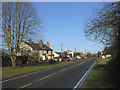
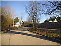
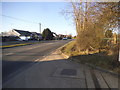
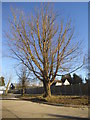
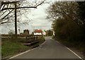
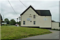
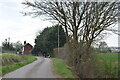
Chelmsford Rural West Ward sits within the City of Chelmsford local government district in Essex, covering 59.3 square kilometres of land. This ward encompasses the villages of Pleshey, Good Easter, Chignall Smealy, Chignall St. James, Roxwell and Highwood. The population stood at 2,764 according to the 2011 Census. The area is characterised by its rural setting, featuring many villages and hamlets outside the principal settlement. Pleshey remains a notable settlement, known for the ruins of a castle mentioned in William Shakespeare's play *Richard II*. You can trace the entire circuit of these castle walls within the modern village streets. The ward benefits from excellent digital connectivity with a fixed broadband quality score of 87 out of 100. This high standard supports reliable online working and essential digital services for residents. While specific predictions about future trends are not included, the current infrastructure provides a solid foundation for modern living. The ward has no Ramsar wetland sites and no Areas of Outstanding Natural Beauty coverage. However, it does contain protected woodland, which adds to its natural character. Living in Chelmsford Rural West Ward offers access to a mix of historic features and open space without the constraints found in more protected national parks. The ward lies in the western part of the borough, providing a distinct sense of place away from the urban core. You can find homes in Chelmsford Rural West Ward that balance rural tranquility with reasonable access to nearby transport links.
- Area Type
- District Borough Unitary Ward
- Area Size
- 59.3 km²
- Population
- Not available
- Population Density
- Not available
Demographics
The community in Chelmsford Rural West Ward presents a distinct demographic profile compared to many urban areas. The median age is 70 years old, indicating that the population skews much older than the national average. This is evident in the age data which places the total age range as the most common category. House ownership stands at 78 per cent, a figure that is significantly higher than the average for the United Kingdom. This high rate of ownership suggests a community where residents have long-term stakes in their local property market. Accommodation type data is available in the records, though specific breakdowns of house versus flat sales are not detailed. You will find that the majority of properties are owned outright or with a mortgage rather than rented. Diversity metrics are present in the official records, though specific percentages for ethnic groups and religious affiliations are not provided. Crime statistics offer a reassuring view of the neighbourhood. The area has a safety score of 71 out of 100, which indicates low crime risk and below-average crime rates. This score reflects a safer environment for families and retirees alike. The rural character of the ward, covering villages like Roxwell and Chignall, contributes to a quieter lifestyle. There are no scoring indicators for specific deprivation measures in the current dataset. Anyone looking at demographics for Chelmsford Rural West Ward must focus on this elderly, owner-occupied population structure.
Household Size
Accommodation Type
Tenure
Ethnic Group
Religion
Household Composition
Age
Household Deprivation
NS-SEC
Explore more demographic insights in this area
Go to Demographics tabPlanning
Planning Constraints
- Flood RiskPremium
- Ramsar Wetland SitesPremium
- Area of Outstanding Natural BeautyPremium
- Protected Nature ReservePremium
- Protected WoodlandPremium