Area Overview for Chafford and North Stifford Ward
Photos of Chafford and North Stifford Ward
Area Information
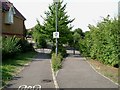
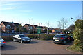
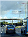
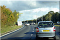
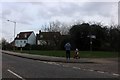
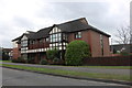
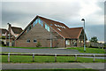
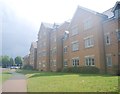
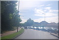
Chafford and North Stifford Ward sits 18 miles east of London within Thurrock Council, comprising distinct areas of Chafford Hundred and North Stifford. This ward covers 2.3 km² and holds a population of 1,850 residents. The location is bounded by the A13 at Arterial Road to the north and sits adjacent to the well-known Lakeside Shopping Centre. Chafford Hundred itself lies one mile north-west of Grays Town Centre, connected to the railway station by a skybridge. The broader Grays Urban Area, which encompasses this ward, recorded a population of 99,462 at the 2021 census. Living in Chafford and North Stifford Ward means inhabiting an area shaped by significant post-war development and historical parish roots. The ward was formed from parts of Stifford and West Thurrock, with Mill Lane marking the historic border between them. Over time, the administrative structure has evolved, creating the current electoral ward that elects two councillors to Thurrock Council. The compact size of the ward, particularly when compared to larger urban districts, results in a high population density of 792 people per square kilometre. This density reflects a mix of suburban housing and village life. Prospective residents can expect a community deeply integrated with local commercial hubs like Lakeside while maintaining proximity to younger parts of the wider Grays Urban Area. Daily life here is defined by this balance, offering access to major transport links and retail facilities within a defined geographical blob that blends suburban sprawl with traditional village boundaries.
- Area Type
- District Borough Unitary Ward
- Area Size
- 2.3 km²
- Population
- 1850
- Population Density
- 792 people/km²
Demographics
Over 70% of Chafford and North Stifford Ward is owned by the residents, with home ownership standing at 77%. This figure indicates a community where most people live in properties they own outright or have a mortgage, rather than renting long-term. The median age for residents in Chafford and North Stifford Ward is 70, placing it among the older wards in the country. This age profile suggests the housing stock is likely dominated by family homes suitable for retirees. You will find that the most common age range represents the total population without a specific sub-range being highlighted, reinforcing the prevalence of older demographics across the board. The ward is not an exception in terms of ethnic diversity or religious composition, as records show total figures for these categories without specific breakdowns being provided for this specific electoral division. While specific household composition data is not detailed in the current records, the high home ownership rate alongside the advanced median age points towards a settled community. The density of 792 people per square kilometre ensures that despite the older demographic, the living arrangements remain relatively close-knit. Living in Chafford and North Stifford Ward means joining a neighbourhood where the majority of neighbours are owners rather than tenants. This stability often correlates with lower tenant turnover and a stronger sense of locality, typical of areas dominated by owner-occupied stock.
Household Size
Accommodation Type
Tenure
Ethnic Group
Religion
Household Composition
Age
Household Deprivation
NS-SEC
Explore more demographic insights in this area
Go to Demographics tabPlanning
Planning Constraints
- Flood RiskPremium
- Ramsar Wetland SitesPremium
- Area of Outstanding Natural BeautyPremium
- Protected Nature ReservePremium
- Protected WoodlandPremium
- Crime RiskPremium