Area Overview for CB9 8PD
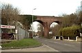
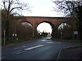
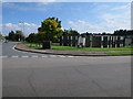
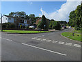
Photos of CB9 8PD


Area Information
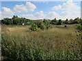
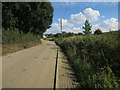
Living in CB9 8PD means being part of a small, tightly knit residential cluster in the heart of Haverhill, Suffolk. This postcode area covers 6,238 square metres and is home to 2,111 people, making it one of the most densely populated areas in the region. Despite its compact size, CB9 8PD sits at the crossroads of Suffolk, Essex, and Cambridgeshire, offering proximity to larger towns while retaining a distinct local identity. The area’s history as a market town dates back over nine centuries, with roots in the Domesday Book and royal connections to Henry VIII’s fourth wife, Anne of Cleves. Today, residents benefit from a blend of historical architecture, such as the Tudor-era Anne of Cleves’ House and the 1889 Corn Exchange, alongside modern amenities. Daily life here is shaped by the town’s role as a commercial hub, with a focus on retail and community services. The compact nature of CB9 8PD means residents are within easy reach of essential services, though the area’s small size also means its character is defined by its historical continuity and close-knit community.
- Area Type
- Postcode
- Area Size
- 6238 m²
- Population
- 2111
- Population Density
- 2113 people/km²
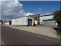
The property market in CB9 8PD is characterised by a high rate of home ownership—60% of residents own their homes—indicating a community where property is viewed as a long-term investment. The predominant accommodation type is houses, which suggests a mix of older, historically significant properties and more modern builds. Given the area’s small size and high population density, the housing stock is likely limited, with properties concentrated in a compact residential cluster. This makes CB9 8PD a niche market, potentially appealing to buyers seeking owner-occupied homes in a historically rich environment. The lack of rental data means it is unclear whether the area functions as a primary rental market or if most properties are held by long-term owners. For buyers, the focus on houses rather than flats or apartments means the area may cater to those prioritising space and traditional housing over high-density living. The compact nature of the postcode also means that property values could be influenced by proximity to local amenities and historical landmarks.
House Prices in CB9 8PD
No properties found in this postcode.
Energy Efficiency in CB9 8PD
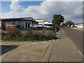
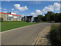
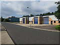
Residents of CB9 8PD have access to a range of nearby amenities, including five retail outlets such as Iceland Haverhill, Morrisons Daily, and Spar, which provide essential shopping and grocery needs. These stores are within practical reach, contributing to a convenient daily life in the area. The town’s historical character, with its Victorian buildings and the Corn Exchange, adds a unique aesthetic to the local environment. While the data does not specify dining or leisure options, the presence of a market town suggests a variety of local businesses and services. The compact nature of the postcode means that residents can easily access shops, services, and community hubs without long commutes. The blend of historical architecture and modern retail creates a lifestyle that balances tradition with practicality. For those prioritising convenience, the proximity of these amenities makes CB9 8PD an attractive choice, though further details on dining or recreational facilities remain unprovided.
Amenities
Schools
| Rank | School | Type | Entry gender | Ages |
|---|
Explore more schools in this area
Go to Schools tabDemographics
The population of CB9 8PD is 2,111, with a median age of 47, indicating a mature demographic skewed towards adults aged 30–64. This age group constitutes the majority, suggesting a community focused on stability and established careers. Home ownership is strong, with 60% of residents owning their homes, and the predominant accommodation type is houses, reflecting a residential area with a mix of older and newer properties. The predominant ethnic group is White, though no specific data on diversity or deprivation is provided. The high population density—338,416 people per square kilometre—suggests a compact, possibly multi-generational living environment. This density, combined with the median age, implies a community where families and long-term residents coexist, with limited turnover. The absence of specific data on income or deprivation means the area’s socioeconomic profile remains partially opaque, but the high home ownership rate suggests a degree of financial stability among residents.
Household Size
Accommodation Type
Tenure
Ethnic Group
Religion
Household Composition
Age
Household Deprivation
NS-SEC
Explore more demographic insights in this area
Go to Demographics tabPlanning
Planning Constraints
- Flood RiskPremium
- Ramsar Wetland SitesPremium
- Area of Outstanding Natural BeautyPremium
- Protected Nature ReservePremium
- Protected WoodlandPremium