Area Overview for CB9 7WH
Photos of CB9 7WH
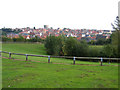
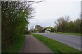
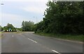
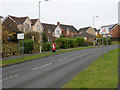
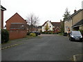
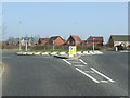
9 photos from this area
Area Information
Key information about the CB9 7WH including its size, population, and administrative classification.
- Area Type
- Postcode
- Area Size
- 7212 m²
- Population
- 2245
- Population Density
- 1505 people/km²
House Prices in CB9 7WH
13
Properties
£324,035
Average Sold Price
£153,000
Lowest Price
£495,000
Highest Price
Showing 13 properties
| Address | Type | Beds | Baths | Last Sale Price | Last Sale Date | |
|---|---|---|---|---|---|---|
| 15 Calford Drive, Haverhill, CB9 7WH | Detached | 5 | 2 | £495,000 | Jul 2025 | |
| 5 Calford Drive, Haverhill, CB9 7WH | Detached | 5 | - | £485,000 | Jul 2023 | |
| 3 Calford Drive, Haverhill, CB9 7WH | Bungalow | 3 | 2 | £475,000 | Nov 2022 | |
| 23 Calford Drive, Haverhill, CB9 7WH | house | - | - | £392,500 | Dec 2021 | |
| 27 Calford Drive, Haverhill, CB9 7WH | Detached | 4 | 3 | £405,000 | Sep 2016 | |
| 21 Calford Drive, Haverhill, CB9 7WH | Detached | 6 | 2 | £325,000 | Jan 2016 | |
| 25 Calford Drive, Haverhill, CB9 7WH | Detached | 5 | - | £305,000 | May 2015 | |
| 17 Calford Drive, Haverhill, CB9 7WH | Detached | 6 | 2 | £300,000 | Aug 2014 | |
| 7 Calford Drive, Haverhill, CB9 7WH | Detached | 4 | 3 | £250,000 | Aug 2009 | |
| 1 Calford Drive, Haverhill, CB9 7WH | Retail | 6 | 2 | £232,000 | Aug 2006 |
Page 1 of 2
Energy Efficiency in CB9 7WH
Amenities
Schools
| Rank | School | Type | Entry gender | Ages |
|---|
Explore more schools in this area
Go to Schools tabDemographics
Household Size
Family (3-5 people)
most common
Accommodation Type
Houses
most common
Tenure
79
majority
Ethnic Group
White
most common
Religion
N/A
most common
Household Composition
N/A
most common
Age
47
median
Adults (30-64 years)
most common
Household Deprivation
N/A
with no deprivation
NS-SEC
35
in Lower managerial occupations
Explore more demographic insights in this area
Go to Demographics tabPlanning
Planning Constraints
- Flood RiskPremium
- Ramsar Wetland SitesPremium
- Area of Outstanding Natural BeautyPremium
- Protected Nature ReservePremium
- Protected WoodlandPremium