Area Overview for CB9 7UF
Photos of CB9 7UF
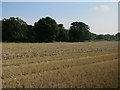
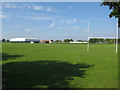
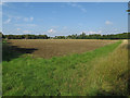
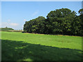
36 photos from this area
Area Information
Key information about the CB9 7UF including its size, population, and administrative classification.
- Area Type
- Postcode
- Area Size
- 1.5 hectares
- Population
- 2581
- Population Density
- 44 people/km²
House Prices in CB9 7UF
20
Properties
£486,375
Average Sold Price
£407,400
Lowest Price
£604,995
Highest Price
Showing 20 properties
| Address | Type | Beds | Baths | Last Sale Price | Last Sale Date | |
|---|---|---|---|---|---|---|
| 12 Broughton Drive, Haverhill, CB9 7UF | house | - | - | £520,000 | Sep 2024 | |
| 8 Broughton Drive, Haverhill, CB9 7UF | Detached | 4 | 2 | £446,995 | Jul 2023 | |
| 10 Broughton Drive, Haverhill, CB9 7UF | house | - | - | £419,995 | Jun 2023 | |
| 6 Broughton Drive, Haverhill, CB9 7UF | house | - | - | £489,995 | May 2023 | |
| 16 Broughton Drive, Haverhill, CB9 7UF | house | - | - | £594,995 | Mar 2023 | |
| 9 Broughton Drive, Haverhill, CB9 7UF | house | - | - | £484,995 | Mar 2023 | |
| 15 Broughton Drive, Haverhill, CB9 7UF | house | - | - | £554,995 | Feb 2023 | |
| 14 Broughton Drive, Haverhill, CB9 7UF | house | - | - | £604,995 | Dec 2022 | |
| 3 Broughton Drive, Haverhill, CB9 7UF | house | - | - | £589,995 | Aug 2022 | |
| 18 Broughton Drive, Haverhill, CB9 7UF | house | - | - | £534,995 | Jun 2022 |
Page 1 of 2
Energy Efficiency in CB9 7UF
Amenities
Schools
| Rank | School | Type | Entry gender | Ages |
|---|
Explore more schools in this area
Go to Schools tabDemographics
Household Size
Two person
most common
Accommodation Type
Houses
most common
Tenure
70
majority
Ethnic Group
White
most common
Religion
N/A
most common
Household Composition
N/A
most common
Age
47
median
Adults (30-64 years)
most common
Household Deprivation
N/A
with no deprivation
NS-SEC
42
in Lower managerial occupations
Explore more demographic insights in this area
Go to Demographics tabPlanning
Planning Constraints
- Flood RiskPremium
- Ramsar Wetland SitesPremium
- Area of Outstanding Natural BeautyPremium
- Protected Nature ReservePremium
- Protected WoodlandPremium