Area Overview for CB9 7RD
Photos of CB9 7RD
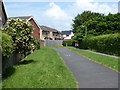
24 photos from this area
Area Information
Key information about the CB9 7RD including its size, population, and administrative classification.
- Area Type
- Postcode
- Area Size
- 1.7 hectares
- Population
- 2761
- Population Density
- 2702 people/km²
House Prices in CB9 7RD
33
Properties
£215,165
Average Sold Price
£116,000
Lowest Price
£362,500
Highest Price
Showing 33 properties
| Address | Type | Beds | Baths | Last Sale Price | Last Sale Date | |
|---|---|---|---|---|---|---|
| 54 Bellings Road, Haverhill, CB9 7RD | Semi-detached | 4 | 2 | £360,000 | Dec 2024 | |
| 34 Bellings Road, Haverhill, CB9 7RD | Terraced | 2 | - | £210,000 | Dec 2024 | |
| 38 Bellings Road, Haverhill, CB9 7RD | Semi-detached | 3 | 2 | £265,000 | Sep 2021 | |
| 60 Bellings Road, Haverhill, CB9 7RD | Detached | 4 | - | £357,500 | Oct 2020 | |
| 62 Bellings Road, Haverhill, CB9 7RD | Detached | 4 | 2 | £362,500 | Aug 2017 | |
| 40 Bellings Road, Haverhill, CB9 7RD | Semi-detached | 3 | 2 | £247,000 | Jun 2017 | |
| 36 Bellings Road, Haverhill, CB9 7RD | Terraced | 2 | 1 | £197,000 | Jan 2017 | |
| 66 Bellings Road, Haverhill, CB9 7RD | house | 4 | - | £260,000 | Dec 2014 | |
| 50 Bellings Road, Haverhill, CB9 7RD | Terraced | 1 | 1 | £118,000 | Jan 2012 | |
| 48 Bellings Road, Haverhill, CB9 7RD | Flat | - | - | £124,000 | Aug 2011 |
Page 1 of 4
Energy Efficiency in CB9 7RD
Amenities
Schools
| Rank | School | Type | Entry gender | Ages |
|---|
Explore more schools in this area
Go to Schools tabDemographics
Household Size
Family (3-5 people)
most common
Accommodation Type
Houses
most common
Tenure
57
majority
Ethnic Group
White
most common
Religion
N/A
most common
Household Composition
N/A
most common
Age
47
median
Adults (30-64 years)
most common
Household Deprivation
N/A
with no deprivation
NS-SEC
28
in Lower managerial occupations
Explore more demographic insights in this area
Go to Demographics tabPlanning
Planning Constraints
- Flood RiskPremium
- Ramsar Wetland SitesPremium
- Area of Outstanding Natural BeautyPremium
- Protected Nature ReservePremium
- Protected WoodlandPremium