Area Overview for CB9 7GD
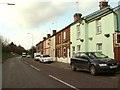
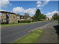
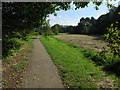
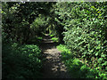
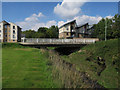
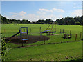
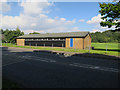
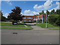
Photos of CB9 7GD


Area Information
Living in CB9 7GD means being part of a small, tightly knit residential cluster in the heart of Haverhill, Suffolk. With a population of 2,309 and a density of 1,765 people per square kilometre, this area is compact yet vibrant, blending historical significance with modern convenience. Haverhill itself is a market town with roots stretching back over 900 years, marked by royal connections and a turbulent history, including a devastating fire in 1667. Today, the town retains character through its Tudor-era buildings and Victorian architecture, offering a sense of continuity. Residents here benefit from proximity to local amenities, schools, and transport links, while the surrounding countryside provides a contrast to the town’s historic core. The area’s mix of older homes and community-focused infrastructure makes it appealing to those seeking a balance between tradition and practicality. For buyers, CB9 7GD represents a chance to live in a place where history is tangible, and daily life is shaped by a modest but functional urban environment.
- Area Type
- Postcode
- Area Size
- Not available
- Population
- 2309
- Population Density
- 1765 people/km²
The property market in CB9 7GD is defined by its predominantly owner-occupied housing stock, with 50% of homes owned by residents rather than rented. The accommodation type is exclusively houses, which contrasts with areas where flats or apartments predominate. This suggests a focus on family homes and long-term occupancy, typical of smaller towns with limited high-density development. Given the area’s compact size and population of 2,309, the housing stock is likely limited in scale, with properties concentrated around Haverhill’s historic core. Buyers should expect a market where homes are not frequently available, as the small area’s supply is constrained. The absence of rental data means it is unclear whether the remaining 50% of properties are let to tenants or occupied by owner-occupiers. For those seeking a home, the emphasis on houses may appeal to families, though the limited inventory could mean longer search times compared to larger urban areas.
House Prices in CB9 7GD
Showing 14 properties
| Address | Type | Beds | Baths | Last Sale Price | Last Sale Date | |
|---|---|---|---|---|---|---|
| 14 Widdowson Way, Withersfield, CB9 7GD | Terraced | - | - | - | - | |
| 6 Widdowson Way, Withersfield, CB9 7GD | Terraced | - | - | - | - | |
| 11 Ayrton Way, Withersfield, CB9 7GD | Terraced | - | - | - | - | |
| 10 Widdowson Way, Withersfield, CB9 7GD | Detached | - | - | - | - | |
| 1 Widdowson Way, Withersfield, CB9 7GD | Semi-detached | - | - | - | - | |
| 12 Widdowson Way, Withersfield, CB9 7GD | Semi-detached | - | - | - | - | |
| 15 Ayrton Way, Withersfield, CB9 7GD | Semi-detached | - | - | - | - | |
| 8 Widdowson Way, Withersfield, CB9 7GD | Semi-detached | - | - | - | - | |
| 16 Widdowson Way, Withersfield, CB9 7GD | Semi-detached | - | - | - | - | |
| 4 Widdowson Way, Withersfield, CB9 7GD | Semi-detached | - | - | - | - |
Energy Efficiency in CB9 7GD
The lifestyle in CB9 7GD is shaped by its proximity to Haverhill’s town centre, where residents have access to five retail outlets, including Budgens Haverhill, Lidl Haverhill, and Spar. These shops provide essential groceries and everyday conveniences, though the selection is limited compared to larger towns. The area’s compact nature means that amenities are concentrated within a short walk or drive, reducing the need for long commutes. While no parks or leisure facilities are explicitly mentioned in the data, Haverhill’s historical character and surrounding countryside likely offer recreational opportunities. The presence of Victorian and Tudor buildings adds to the town’s charm, creating a distinct atmosphere that blends heritage with modern living. For residents, the balance of practical amenities and historic surroundings fosters a lifestyle that is both functional and rooted in local tradition.
Amenities
Schools
The schools nearest to CB9 7GD include Westfield Community Primary School and Westfield Primary Academy, both of which are primary institutions. Westfield Primary Academy holds a good Ofsted rating, indicating a satisfactory standard of education. The presence of two primary schools within the area provides families with options for their children’s early education, though no secondary schools are listed in the data. This suggests that residents may need to travel beyond CB9 7GD for secondary schooling, which is common in smaller towns. The good rating at Westfield Primary Academy is a positive indicator for parents prioritising quality education, though the absence of detailed performance metrics means further research would be needed to compare with other local schools. For families, the proximity of these schools is a practical advantage, reducing the need for long commutes.
| Rank | School | Type | Entry gender | Ages |
|---|
Explore more schools in this area
Go to Schools tabDemographics
The community in CB9 7GD is predominantly composed of adults aged 30–64, with a median age of 47. This suggests a mature, stable population, likely with established careers and family ties. Home ownership stands at 50%, indicating a mix of owner-occupied and rental properties, though the data does not specify the latter. The area is characterised by houses rather than flats, reflecting a traditional housing stock suited to family living. The predominant ethnic group is White, which aligns with broader demographic trends in rural Suffolk. While no specific deprivation data is provided, the age profile and housing type suggest a community focused on long-term stability rather than transient populations. The absence of detailed diversity metrics means the area’s social fabric is largely homogenous, though this does not necessarily imply a lack of inclusivity. For residents, the demographic balance likely contributes to a quiet, low-key lifestyle with minimal turnover.
Household Size
Accommodation Type
Tenure
Ethnic Group
Religion
Household Composition
Age
Household Deprivation
NS-SEC
Explore more demographic insights in this area
Go to Demographics tabPlanning
Planning Constraints
- Flood RiskPremium
- Ramsar Wetland SitesPremium
- Area of Outstanding Natural BeautyPremium
- Protected Nature ReservePremium
- Protected WoodlandPremium