Area Overview for CB9 7AS
Photos of CB9 7AS
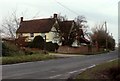
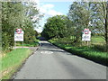
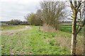
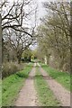
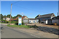
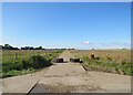
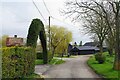
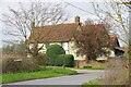
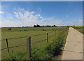
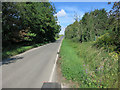
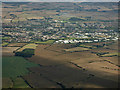
11 photos from this area
Area Information
Key information about the CB9 7AS including its size, population, and administrative classification.
- Area Type
- Postcode
- Area Size
- 39.5 hectares
- Population
- 1086
- Population Density
- 86 people/km²
House Prices in CB9 7AS
16
Properties
£552,111
Average Sold Price
£200,000
Lowest Price
£1,500,000
Highest Price
Showing 16 properties
| Address | Type | Beds | Baths | Last Sale Price | Last Sale Date | |
|---|---|---|---|---|---|---|
| Inglenook Cottage, Camps Road, Helions Bumpstead, CB9 7AS | Cottage | 3 | 2 | £615,000 | Feb 2024 | |
| Manana, Camps Road, Helions Bumpstead, CB9 7AS | Retail | 3 | 1 | £315,000 | Feb 2023 | |
| The Old Vicarage, Camps Road, Helions Bumpstead, CB9 7AS | Retail | 7 | 3 | £1,500,000 | Oct 2022 | |
| Crown Cottage, Camps Road, Helions Bumpstead, CB9 7AS | house | - | - | £490,000 | Nov 2020 | |
| The Meadows, Camps Road, Helions Bumpstead, CB9 7AS | Detached | 4 | 3 | £875,000 | Jul 2017 | |
| Ashlawn Cottage, Camps Road, Helions Bumpstead, CB9 7AS | Detached | 3 | 2 | £200,000 | Jul 2017 | |
| Pavillion Cottage, Camps Road, Helions Bumpstead, CB9 7AS | Detached | 4 | - | £475,000 | Aug 2016 | |
| By The Way, Camps Road, Helions Bumpstead, CB9 7AS | Detached | - | - | £209,000 | Jul 1999 | |
| Moss Farm, Camps Road, Helions Bumpstead, CB9 7AS | Detached | - | - | £290,000 | Jan 1996 | |
| The Old Marquis, Camps Road, Helions Bumpstead, CB9 7AS | Detached | 5 | 2 | - | - |
Page 1 of 2
Energy Efficiency in CB9 7AS
Amenities
Schools
| Rank | School | Type | Entry gender | Ages |
|---|
Explore more schools in this area
Go to Schools tabDemographics
Household Size
Two person
most common
Accommodation Type
Houses
most common
Tenure
75
majority
Ethnic Group
White
most common
Religion
N/A
most common
Household Composition
N/A
most common
Age
47
median
Adults (30-64 years)
most common
Household Deprivation
N/A
with no deprivation
NS-SEC
41
in Lower managerial occupations
Explore more demographic insights in this area
Go to Demographics tabPlanning
Planning Constraints
- Flood RiskPremium
- Ramsar Wetland SitesPremium
- Area of Outstanding Natural BeautyPremium
- Protected Nature ReservePremium
- Protected WoodlandPremium