Area Overview for CB9 0PA
Photos of CB9 0PA
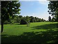
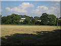
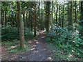
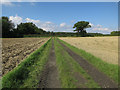
41 photos from this area
Area Information
Key information about the CB9 0PA including its size, population, and administrative classification.
- Area Type
- Postcode
- Area Size
- 2.1 hectares
- Population
- 2309
- Population Density
- 1765 people/km²
House Prices in CB9 0PA
36
Properties
£207,970
Average Sold Price
£61,495
Lowest Price
£380,000
Highest Price
Showing 36 properties
| Address | Type | Beds | Baths | Last Sale Price | Last Sale Date | |
|---|---|---|---|---|---|---|
| 33 Osprey Road, Haverhill, CB9 0PA | Detached | 4 | 2 | £380,000 | Oct 2025 | |
| 26 Osprey Road, Haverhill, CB9 0PA | Detached | 3 | 2 | £330,000 | Nov 2023 | |
| 34 Osprey Road, Haverhill, CB9 0PA | house | - | - | £375,000 | Jun 2022 | |
| 16 Osprey Road, Haverhill, CB9 0PA | house | - | - | £295,000 | Jan 2022 | |
| 23 Osprey Road, Haverhill, CB9 0PA | Detached | 3 | 2 | £295,000 | Jun 2021 | |
| 28 Osprey Road, Haverhill, CB9 0PA | Detached | 4 | 2 | £310,000 | Aug 2020 | |
| 35 Osprey Road, Haverhill, CB9 0PA | house | - | - | £325,000 | Nov 2019 | |
| 32 Osprey Road, Haverhill, CB9 0PA | Detached | 3 | 2 | £245,000 | Sep 2019 | |
| 38 Osprey Road, Haverhill, CB9 0PA | Detached | 3 | 2 | £310,000 | Mar 2017 | |
| 17 Osprey Road, Haverhill, CB9 0PA | Detached | 3 | 2 | £250,000 | Feb 2017 |
Page 1 of 4
Energy Efficiency in CB9 0PA
Amenities
Schools
| Rank | School | Type | Entry gender | Ages |
|---|
Explore more schools in this area
Go to Schools tabDemographics
Household Size
Family (3-5 people)
most common
Accommodation Type
Houses
most common
Tenure
50
majority
Ethnic Group
White
most common
Religion
N/A
most common
Household Composition
N/A
most common
Age
47
median
Adults (30-64 years)
most common
Household Deprivation
N/A
with no deprivation
NS-SEC
24
in Lower managerial occupations
Explore more demographic insights in this area
Go to Demographics tabPlanning
Planning Constraints
- Flood RiskPremium
- Ramsar Wetland SitesPremium
- Area of Outstanding Natural BeautyPremium
- Protected Nature ReservePremium
- Protected WoodlandPremium