Area Overview for CB9 0NY
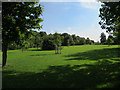
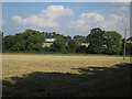
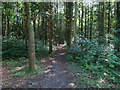
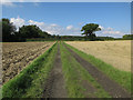
Photos of CB9 0NY
Area Information
Living in CB9 0NY means inhabiting a small, tightly knit residential cluster in the heart of Haverhill, Suffolk. With a population of 1,592, this area blends historical significance with modern convenience. Haverhill itself is a market town with roots stretching back to the Domesday Book, positioned at the crossroads of Essex and Cambridgeshire. The town’s character is shaped by its medieval origins, including the Tudor-era Anne of Cleves’ House and the 1889 Corn Exchange. Daily life here is defined by a quiet, community-focused rhythm, with local amenities and schools within easy reach. The area’s compact size ensures a sense of familiarity, while its proximity to major roads and transport links offers flexibility for commuters. Though small, CB9 0NY benefits from a well-established infrastructure, including retail outlets and a range of educational options. For those seeking a balance between heritage and practicality, this postcode offers a slice of Suffolk’s storied past with the comforts of contemporary living.
- Area Type
- Postcode
- Area Size
- Not available
- Population
- 1592
- Population Density
- 3854 people/km²
The property market in CB9 0NY is dominated by owner-occupied homes, with 90% of properties in private hands. This high rate of home ownership points to a community that values long-term investment and stability. The accommodation type is exclusively houses, which contrasts with areas where flats or apartments predominate. This suggests a focus on family homes, likely with gardens and more space, appealing to those prioritising privacy and traditional living. Given the small size of the postcode area, the housing stock is limited, meaning buyers may need to consider nearby neighbourhoods for more options. However, the concentration of houses here indicates a consistent demand for residential properties in this setting. For those seeking a quiet, established area with a strong sense of community, CB9 0NY offers a straightforward, owner-occupied market with minimal rental activity.
House Prices in CB9 0NY
No properties found in this postcode.
Energy Efficiency in CB9 0NY
The lifestyle in CB9 0NY is shaped by its proximity to Haverhill’s retail and historical amenities. Within practical reach are five notable retail outlets, including Budgens Haverhill, Lidl Haverhill, and Spar, offering everyday shopping convenience. The town’s character is defined by its Victorian architecture and historic sites, such as the Corn Exchange, which contribute to a sense of place. While no parks or leisure facilities are explicitly listed, the area’s small size and historical focus suggest a slower pace of life, with opportunities for walking or exploring local landmarks. The blend of practical amenities and heritage makes daily life here both functional and rooted in tradition, appealing to those who value accessibility without sacrificing charm.
Amenities
Schools
Residents of CB9 0NY have access to a mix of primary and special schools, including Coupals Community Primary School, Churchill Special Free School, and Coupals Primary Academy, which holds a ‘good’ Ofsted rating. The presence of both mainstream and special educational institutions provides families with options tailored to different needs, from general primary education to specialist support. The ‘good’ rating at Coupals Primary Academy suggests a school delivering consistent quality in teaching and outcomes. While no secondary schools are listed, the proximity to Haverhill’s broader infrastructure implies additional options within a short commute. This combination of school types reflects a community prioritising accessible, diverse education, ensuring children can attend institutions that align with their learning requirements.
| Rank | School | Type | Entry gender | Ages |
|---|
Explore more schools in this area
Go to Schools tabDemographics
The community in CB9 0NY is predominantly composed of adults aged 30–64, with a median age of 47. This suggests a mature, settled population, likely with established careers and families. Home ownership is exceptionally high at 90%, reflecting a strong preference for long-term residency over rental properties. The area is characterised by houses rather than flats, indicating a focus on family-friendly, spacious living. The predominant ethnic group is White, which aligns with broader demographic trends in the region. The absence of specific data on deprivation means the quality of life here cannot be assessed in that context, but the high home ownership and age profile suggest stability and low turnover. This makes CB9 0NY a place where residents are likely to remain for extended periods, fostering a cohesive, familiar community feel.
Household Size
Accommodation Type
Tenure
Ethnic Group
Religion
Household Composition
Age
Household Deprivation
NS-SEC
Explore more demographic insights in this area
Go to Demographics tabPlanning
Planning Constraints
- Flood RiskPremium
- Ramsar Wetland SitesPremium
- Area of Outstanding Natural BeautyPremium
- Protected Nature ReservePremium
- Protected WoodlandPremium