Area Overview for CB9 0LD
Photos of CB9 0LD
Area Information
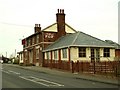
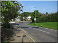
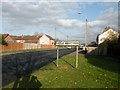
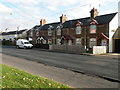
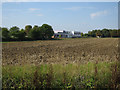
Living in CB9 0LD, a small residential cluster in Suffolk, offers a blend of historical significance and modern practicality. With a population of 1,852, the area is part of Haverhill, a market town with roots stretching back to pre-Roman times. Its compact size means a tight-knit community, where daily life is shaped by its role as a commercial and administrative hub. The town’s medieval origins are still visible in structures like Anne of Cleves’ House and the Corn Exchange, while its economy has evolved to include retail and services. CB9 0LD sits at the edge of Haverhill’s historic core, offering proximity to both heritage and contemporary amenities. Residents benefit from a well-established infrastructure, including primary schools, retail outlets, and transport links. The area’s appeal lies in its balance: a manageable population, a focus on owner-occupied homes, and a community profile skewed toward adults aged 30–64. For those seeking a place with character but without the density of larger towns, CB9 0LD provides a quiet, functional base.
- Area Type
- Postcode
- Area Size
- Not available
- Population
- 1852
- Population Density
- 3723 people/km²
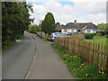
The property market in CB9 0LD is dominated by owner-occupied homes, with 53% of residents owning their properties. The accommodation type is predominantly houses, which is typical of smaller towns and suburbs. This suggests a market that caters to families and individuals seeking more space than flats can offer. The low population density and focus on single-family homes indicate that the area is not a rental hotspot but rather a place where long-term ownership is the norm. For buyers, this means a limited number of properties available, particularly in the immediate vicinity. The housing stock likely includes a mix of older and newer builds, reflecting Haverhill’s historical development and modern expansion. Prospective buyers should consider the area’s compact size, which may mean competition for available properties, especially near key amenities like schools and retail.
House Prices in CB9 0LD
Showing 2 properties
| Address | Type | Beds | Baths | Last Sale Price | Last Sale Date | |
|---|---|---|---|---|---|---|
| Pre School, Samuel Ward Academy, Chalkstone Way, Haverhill, CB9 0LD | education | - | - | - | - | |
| Samuel Ward Academy, Chalkstone Way, Haverhill, CB9 0LD | commercial | - | - | - | - |
Energy Efficiency in CB9 0LD
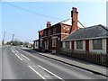
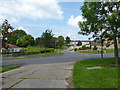
The lifestyle in CB9 0LD is supported by a range of nearby amenities, including five retail outlets such as Tesco Haverhill, Aldi Haverhill, and Morrisons Daily. These shops provide access to everyday essentials, reducing the need for long commutes to larger centres. The area’s proximity to Haverhill’s historic core also offers cultural and recreational opportunities, though specific parks or leisure facilities are not detailed in the data. The presence of multiple retail options within practical reach enhances convenience, particularly for families and individuals prioritising accessibility. The mix of local shops and the town’s historical character suggests a community that values both practicality and tradition. While the data does not specify dining or leisure venues, the retail infrastructure implies a functional, self-sufficient environment for daily needs.
Amenities
Schools
Residents of CB9 0LD have access to a range of educational institutions, including Chalkstone Middle School, a primary school, and Samuel Ward Arts and Technology College, also a primary school. The area is also served by Samuel Ward Academy, an academy with a ‘good’ Ofsted rating. This mix of primary schools and an academy provides families with options for both early education and secondary schooling. The presence of a high-performing academy suggests a focus on specialist education, potentially offering courses in arts and technology. The proximity of multiple schools within practical reach means parents can choose between different teaching approaches and facilities. The school infrastructure supports the area’s demographic profile, catering to the needs of families with children in a community where the majority are adults aged 30–64.
| Rank | School | Type | Entry gender | Ages |
|---|
Explore more schools in this area
Go to Schools tabDemographics
The community in CB9 0LD is predominantly middle-aged, with a median age of 47 and the most common age range being adults aged 30–64. Home ownership here stands at 53%, reflecting a mix of long-term residents and families. The area is characterised by houses rather than flats, aligning with its suburban, low-density layout. The predominant ethnic group is White, which is consistent with broader trends in the region. This demographic profile suggests a stable, mature population with established routines and a focus on family-oriented living. The absence of specific deprivation data means the area’s quality of life is not explicitly flagged by socioeconomic indicators, though the moderate crime risk and practical amenities suggest a generally secure environment. The age distribution implies a community with a strong presence of working-age adults, potentially supporting local businesses and schools.
Household Size
Accommodation Type
Tenure
Ethnic Group
Religion
Household Composition
Age
Household Deprivation
NS-SEC
Explore more demographic insights in this area
Go to Demographics tabPlanning
Planning Constraints
- Flood RiskPremium
- Ramsar Wetland SitesPremium
- Area of Outstanding Natural BeautyPremium
- Protected Nature ReservePremium
- Protected WoodlandPremium