Area Overview for CB8 7FH
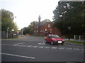
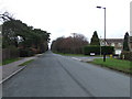
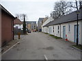
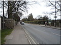
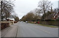
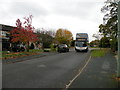
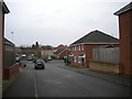
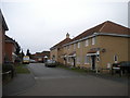
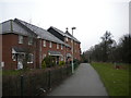
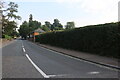
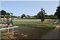
Photos of CB8 7FH

Area Information
Living in CB8 7FH offers a settled residential experience within the historic market town of Newmarket. This specific postcode cluster covers 5,275 square metres, creating a tightly knit environment for its 1,204 residents. The area sits at a population density of 547 people per square kilometre, reflecting a neighbourhood where properties stand in close proximity to their neighbours. Newmarket itself is an ancient market town located in West Suffolk, lying on the Icknield Way and defined by the expansive Newmarket Heath. Your daily life here is anchored by a strong sense of local history, stretching back to the Bronze Age and the royal connections established by James I in the early 17th century. While the immediate vicinity is a residential cluster, you remain connected to the wider town centre and its rich heritage. The character of the area is shaped by its designation as a small residential cluster rather than a sprawling suburb. When considering families, the location provides access to established community spaces. The compact size of the postcode ensures that residents often know one another, fostering a supportive local network. However, the density also means that noise levels can be higher than in more spread-out rural locations. You are living in an area that balances historical significance with modern convenience, situated perfectly for those who value a tight-knit community setting within the Suffolk countryside.
- Area Type
- Postcode
- Area Size
- 5275 m²
- Population
- 1204
- Population Density
- 547 people/km²
Housing in CB8 7FH is characterised almost entirely by houses, with no mention of flats or other apartment types in the local stock. The property market here is dominated by owner-occupied residences, where exactly 50% of residents own their homes. This higher concentration of ownership often correlates with a more stable housing stock, as owner-occupiers are less likely to move frequently than landlords. When looking at homes in CB8 7FH, buyers can expect a residential cluster that prioritises detached or semi-detached living over high-density developments. The small size of the area, covering only 5,275 square metres, limits the inventory to a specific selection of properties within the broader Newmarket area. Buyers looking for rental properties will have a smaller field to choose from, as the rental market here is roughly even with owner-occupiers. The homes are situated within a civil parish that has historically been a mix of Suffolk and Cambridgeshire, adding a layer of unique local identity to any property purchase. If you are accessing CB8 7FH for purchase, your options will be concentrated in the immediate cluster. The high home ownership percentage suggests strong local attachment to these specific properties.
House Prices in CB8 7FH
Showing 28 properties
| Address | Type | Beds | Baths | Last Sale Price | Last Sale Date | |
|---|---|---|---|---|---|---|
| 16 Brewers Lane, Newmarket, CB8 7FH | Semi-detached | 3 | 1 | £280,000 | May 2024 | |
| 11 Brewers Lane, Newmarket, CB8 7FH | Terraced | 1 | 1 | £45,000 | Dec 2011 | |
| 13 Brewers Lane, Newmarket, CB8 7FH | house | - | - | £46,500 | Feb 2011 | |
| 2 Brewers Lane, Newmarket, CB8 7FH | house | 2 | 2 | - | - | |
| 5 Brewers Lane, Newmarket, CB8 7FH | Terraced | 1 | 1 | - | - | |
| 3 Brewers Lane, Newmarket, CB8 7FH | Terraced | 1 | 1 | - | - | |
| 9 Brewers Lane, Newmarket, CB8 7FH | Terraced | 1 | 1 | - | - | |
| 15 Brewers Lane, Newmarket, CB8 7FH | Semi-detached | 3 | - | - | - | |
| Flat 70, The Maltings, Fordham Road, Newmarket, CB8 7FH | Flat | - | - | - | - | |
| Flat 65, The Maltings, Fordham Road, Newmarket, CB8 7FH | Flat | - | - | - | - |
Energy Efficiency in CB8 7FH
Daily life in CB8 7FH is supported by a selection of amenities within practical reach of the residential cluster. You have five notable retail options nearby, anchored by Waitrose Newmarket for premium groceries and Iceland Newmarket for affordable essentials. You can also find M&S Hyperion BP, combining shopping with refuelling if you drive. For those who commute by rail, there are five relevant rail access points close by. These include Newmarket Railway Station, which offers direct links to London Liverpool Street and the rest of the country. The presence of Entrance1 and Entrance2 suggests multiple entry points to the rail network or the town centre, improving convenience for daily travel. When you are looking for amenities in the vicinity of CB8 7FH, you will find that key daily needs are met without long journeys. The combination of high-street retailers and a functional railway station makes this postcode a practical choice for working families. You do not need to travel far to access major supermarket chains or mainline railway stations. This connectivity means that while you live in a local cluster, your travel options remain extensive.
Amenities
Schools
Families considering this area have access to a mix of state and independent educational options within the local vicinity. St Louis Roman Catholic Primary School serves the younger children in the catchment area. Parents seeking an academy option will find St Louis Catholic Academy nearby, which holds a good Ofsted rating. This rating provides reassurance regarding the quality of education provided by the state-funded academy trust. For families looking for a private education, Fairstead House acts as an independent school alternative close by. This variety ensures that different educational philosophies are available directly near CB8 7FH. The presence of a Roman Catholic primary and a Catholic academy indicates that faith-based education is a significant part of the local schooling landscape. When you move to this area, you gain immediate access to these specific institutions without needing to travel far into the wider town. The proximity of Fairstead House means that private schooling costs can be integrated into the daily commute routine. You can choose between the faith-based structure of the Catholic schools or the independent setting of Fairstead House based on your child's needs. All these schools are situated in a way that supports families living in this postcode.
| Rank | School | Type | Entry gender | Ages |
|---|
Explore more schools in this area
Go to Schools tabDemographics
The community in CB8 7FH is defined by a mature age profile, with a median age of 47 years. Most residents fall into the 30 to 64 years age range, indicating that this postcode attracts middle-aged adults and families rather than young professionals or retirees. Because most of the demographic is adults in the 30-64 bracket, the houses found here are likely suited to those with settled lives. Half of the households own their homes, a 50% ownership rate that shows a balanced market between owner-occupiers and renters. The entire local population enjoys houses for accommodation, confirming that you will not find flats or high-density apartments in this specific cluster. The predominant ethnic group is White, reflecting the traditional demographic makeup of this part of Suffolk. The statistical data for this area, as confirmed by the final figures, shows that no other ethnic group holds a majority position. This demographic stability suggests a quiet, predictable social environment. The absence of a younger population under 30 means there may be fewer children playing outside during school holidays compared to areas with more young families. If you are considering living in CB8 7FH, expect a neighbourhood where residents are well-established. The data indicates a straightforward, homogenous community structure typical of English market towns.
Household Size
Accommodation Type
Tenure
Ethnic Group
Religion
Household Composition
Age
Household Deprivation
NS-SEC
Explore more demographic insights in this area
Go to Demographics tabPlanning
Planning Constraints
- Flood RiskPremium
- Ramsar Wetland SitesPremium
- Area of Outstanding Natural BeautyPremium
- Protected Nature ReservePremium
- Protected WoodlandPremium