Area Overview for CB8 0XJ
Photos of CB8 0XJ

Area Information
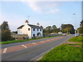
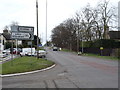
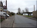
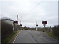
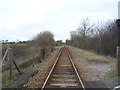
Living in CB8 0XJ means being part of a small, rural cluster in South Cambridgeshire, just 6 miles east of Cambridge. The area’s population of 1,037 is spread across 52 people per square kilometre, reflecting its low-density, village-like character. Historically, Little Wilbraham — the village associated with this postcode — has roots in the Domesday Book, with medieval burials and 17th-century farmhouses still standing. Daily life here is quiet, centred around the church, High Street, and surrounding farms. The area lacks local shops or employment, requiring residents to travel to nearby Great Wilbraham for essentials like a Post Office or schools. Despite its seclusion, CB8 0XJ is accessible via the A11 and A1303 roads, with rail links to Cambridge and Newmarket within a short drive. This blend of rural tranquillity and proximity to urban amenities makes it appealing to those seeking a peaceful, low-density lifestyle without complete isolation.
- Area Type
- Postcode
- Area Size
- Not available
- Population
- 1037
- Population Density
- 52 people/km²
CB8 0XJ is primarily an owner-occupied area, with 70% of homes owned by residents rather than rented. The accommodation type is predominantly houses, not flats or apartments, aligning with the rural, low-density nature of the village. This suggests a housing stock characterised by traditional properties, many of which date to the 17th or 18th centuries, such as timber-framed farmhouses. Given the small population and limited development, the property market here is likely niche, with few new builds or rental opportunities. Buyers should consider that the area’s charm comes with practical trade-offs: limited local amenities, reliance on nearby towns for services, and a need for a car due to sparse public transport. For those seeking a historic home in a peaceful setting, CB8 0XJ offers a unique opportunity, but its small size means competition for available properties.
House Prices in CB8 0XJ
No properties found in this postcode.
Energy Efficiency in CB8 0XJ
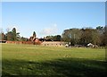
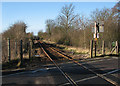
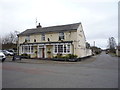
Life in CB8 0XJ is defined by its rural simplicity and reliance on nearby towns for amenities. Within practical reach are five retail outlets, including Spar and Co-op Food, though the village itself has no shops. Residents can access four rail stations, including Newmarket and Dullingham, and two airports, Cambridge Airport, for travel. The area’s character is shaped by its historic buildings, such as the 13th-century Church of St John the Evangelist and The Hole in the Wall pub, a mid-16th-century building. Parks and open spaces are limited, with the surrounding farmland offering natural scenery. The absence of local leisure facilities means residents must travel to Cambridge or Great Wilbraham for dining, entertainment, or sports. This lifestyle suits those who prioritise tranquillity and historical charm over immediate access to urban conveniences.
Amenities
Schools
Residents of CB8 0XJ have access to two primary schools: Great Wilbraham CofE Primary School and Great Wilbraham CofE Primary Academy. Both are state-funded and cater to younger children, though no Ofsted ratings are provided in the data. The presence of two primary schools suggests a focus on early education, with families likely relying on these institutions for their children’s schooling. Given the village’s small size, students may attend these schools before moving to secondary education in nearby towns like Cambridge or Bottisham. The lack of secondary schools in the immediate area means families must plan for commuting or relocation as children grow older. This dynamic is typical for rural villages, where educational options are concentrated in larger nearby settlements.
| Rank | School | Type | Entry gender | Ages |
|---|
Explore more schools in this area
Go to Schools tabDemographics
The community in CB8 0XJ is predominantly middle-aged, with a median age of 47 and 70% of residents owning their homes. The most common age range is 30–64 years, suggesting a stable population with long-term residency. Accommodation is largely houses, not flats, reflecting the area’s rural character. The predominant ethnic group is White, with no specific data on other demographics. Home ownership at 70% indicates a settled community, though the small population size means limited diversity in household types. The low population density of 52 people per square kilometre reinforces the village’s quiet, spread-out nature. While no deprivation data is provided, the absence of major employers or local services suggests residents may rely on nearby towns for work and shopping, shaping a lifestyle centred on commuting or remote work.
Household Size
Accommodation Type
Tenure
Ethnic Group
Religion
Household Composition
Age
Household Deprivation
NS-SEC
Explore more demographic insights in this area
Go to Demographics tabPlanning
Planning Constraints
- Flood RiskPremium
- Ramsar Wetland SitesPremium
- Area of Outstanding Natural BeautyPremium
- Protected Nature ReservePremium
- Protected WoodlandPremium