Area Overview for CB7 5XT
Photos of CB7 5XT
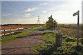

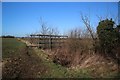
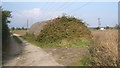
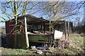

16 photos from this area
Area Information
Key information about the CB7 5XT including its size, population, and administrative classification.
- Area Type
- Postcode
- Area Size
- 1.7 km²
- Population
- 2012
- Population Density
- 92 people/km²
House Prices in CB7 5XT
48
Properties
£310,122
Average Sold Price
£63,250
Lowest Price
£675,000
Highest Price
Showing 48 properties
| Address | Type | Beds | Baths | Last Sale Price | Last Sale Date | |
|---|---|---|---|---|---|---|
| 43 Church Road, Wicken, CB7 5XT | Semi-detached | 3 | 1 | £337,500 | Mar 2025 | |
| 41 Church Road, Wicken, CB7 5XT | Semi-detached | 3 | 1 | £300,000 | Feb 2024 | |
| 26 Church Road, Wicken, CB7 5XT | house | - | - | £640,000 | Nov 2023 | |
| 18 Church Road, Wicken, CB7 5XT | house | - | - | £280,000 | Sep 2023 | |
| 16 Church Road, Wicken, CB7 5XT | house | - | - | £330,000 | Jul 2023 | |
| 20 Church Road, Wicken, CB7 5XT | house | - | - | £310,000 | Jul 2023 | |
| 27 Church Road, Wicken, CB7 5XT | house | - | - | £285,000 | Feb 2021 | |
| Mulberry House, 73 Church Road, Wicken, CB7 5XT | house | - | - | £567,000 | Jun 2020 | |
| 3 Church Road, Wicken, CB7 5XT | Detached | 2 | 1 | £465,000 | May 2020 | |
| Hall Farm, 71 Church Road, Wicken, CB7 5XT | Land | 3 | 2 | £355,000 | Jun 2019 |
Page 1 of 5
Energy Efficiency in CB7 5XT
Amenities
Schools
| Rank | School | Type | Entry gender | Ages |
|---|
Explore more schools in this area
Go to Schools tabDemographics
Household Size
Two person
most common
Accommodation Type
Houses
most common
Tenure
65
majority
Ethnic Group
White
most common
Religion
N/A
most common
Household Composition
N/A
most common
Age
47
median
Adults (30-64 years)
most common
Household Deprivation
N/A
with no deprivation
NS-SEC
37
in Lower managerial occupations
Explore more demographic insights in this area
Go to Demographics tabPlanning
Planning Constraints
- Flood RiskPremium
- Ramsar Wetland SitesPremium
- Area of Outstanding Natural BeautyPremium
- Protected Nature ReservePremium
- Protected WoodlandPremium