Area Overview for CB7 5NG
Photos of CB7 5NG
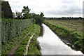
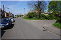
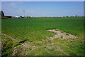
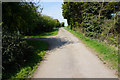
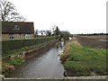
32 photos from this area
Area Information
Key information about the CB7 5NG including its size, population, and administrative classification.
- Area Type
- Postcode
- Area Size
- 18.8 hectares
- Population
- 1739
- Population Density
- 144 people/km²
House Prices in CB7 5NG
42
Properties
£238,556
Average Sold Price
£46,500
Lowest Price
£541,059
Highest Price
Showing 42 properties
| Address | Type | Beds | Baths | Last Sale Price | Last Sale Date | |
|---|---|---|---|---|---|---|
| 36 Carter Street, Fordham, CB7 5NG | Retail | 4 | 2 | £450,000 | Nov 2022 | |
| 12 Carter Street, Fordham, CB7 5NG | Bungalow | - | - | £450,000 | Mar 2021 | |
| Clovelly, 45 Carter Street, Fordham, CB7 5NG | Semi-detached | 3 | - | £195,000 | Jul 2020 | |
| 53 Carter Street, Fordham, CB7 5NG | Terraced | 2 | 1 | £215,000 | Aug 2019 | |
| 41 Carter Street, Fordham, CB7 5NG | Detached | 4 | 1 | £330,000 | Jul 2017 | |
| 22 Carter Street, Fordham, CB7 5NG | Detached | 4 | - | £541,059 | Oct 2016 | |
| 50 Carter Street, Fordham, CB7 5NG | Detached | 5 | 3 | £295,000 | May 2016 | |
| 49 Carter Street, Fordham, CB7 5NG | house | - | - | £120,000 | Sep 2012 | |
| 37 Carter Street, Fordham, CB7 5NG | house | - | - | £170,000 | Feb 2012 | |
| 20A Carter Street, Fordham, CB7 5NG | Retail | - | - | £280,000 | Dec 2009 |
Page 1 of 5
Energy Efficiency in CB7 5NG
Amenities
Schools
| Rank | School | Type | Entry gender | Ages |
|---|
Explore more schools in this area
Go to Schools tabDemographics
Household Size
Two person
most common
Accommodation Type
Houses
most common
Tenure
77
majority
Ethnic Group
White
most common
Religion
N/A
most common
Household Composition
N/A
most common
Age
47
median
Adults (30-64 years)
most common
Household Deprivation
N/A
with no deprivation
NS-SEC
38
in Lower managerial occupations
Explore more demographic insights in this area
Go to Demographics tabPlanning
Planning Constraints
- Flood RiskPremium
- Ramsar Wetland SitesPremium
- Area of Outstanding Natural BeautyPremium
- Protected Nature ReservePremium
- Protected WoodlandPremium