Area Overview for CB7 5EP
Photos of CB7 5EP
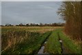
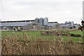

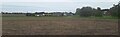
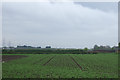
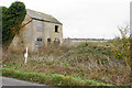
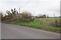
11 photos from this area
Area Information
Key information about the CB7 5EP including its size, population, and administrative classification.
- Area Type
- Postcode
- Area Size
- 95.0 hectares
- Population
- 2058
- Population Density
- 53 people/km²
House Prices in CB7 5EP
53
Properties
£254,500
Average Sold Price
£125,000
Lowest Price
£535,000
Highest Price
Showing 53 properties
| Address | Type | Beds | Baths | Last Sale Price | Last Sale Date | |
|---|---|---|---|---|---|---|
| 28A The Cotes, Soham, CB7 5EP | Bungalow | - | - | £535,000 | Sep 2017 | |
| 21 The Cotes, Soham, CB7 5EP | Detached | - | - | £195,000 | Nov 2009 | |
| The Cotes Bungalow, 18A The Cotes, Soham, CB7 5EP | Semi-detached | 2 | 1 | £163,000 | Jun 2002 | |
| Tigon House, 19 The Cotes, Soham, CB7 5EP | Detached | - | - | £125,000 | May 2002 | |
| 16 The Cotes, Soham, CB7 5EP | Detached | 3 | 1 | - | - | |
| 20B The Cotes, Soham, CB7 5EP | Land | - | - | - | - | |
| 2 The Cotes, Soham, CB7 5EP | house | 3 | 2 | - | - | |
| 5 The Cotes, Soham, CB7 5EP | Semi-detached | 2 | 1 | - | - | |
| 8 The Cotes, Soham, CB7 5EP | Semi-detached | 4 | 2 | - | - | |
| 1 The Cotes, Soham, CB7 5EP | Semi-detached | 2 | 1 | - | - |
Page 1 of 6
Energy Efficiency in CB7 5EP
Amenities
Schools
| Rank | School | Type | Entry gender | Ages |
|---|
Explore more schools in this area
Go to Schools tabDemographics
Household Size
Two person
most common
Accommodation Type
Houses
most common
Tenure
66
majority
Ethnic Group
White
most common
Religion
N/A
most common
Household Composition
N/A
most common
Age
47
median
Adults (30-64 years)
most common
Household Deprivation
N/A
with no deprivation
NS-SEC
31
in Lower managerial occupations
Explore more demographic insights in this area
Go to Demographics tabPlanning
Planning Constraints
- Flood RiskPremium
- Ramsar Wetland SitesPremium
- Area of Outstanding Natural BeautyPremium
- Protected Nature ReservePremium
- Protected WoodlandPremium