Area Overview for CB7 4SA
Photos of CB7 4SA


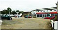
18 photos from this area
Area Information
Key information about the CB7 4SA including its size, population, and administrative classification.
- Area Type
- Postcode
- Area Size
- 6236 m²
- Population
- 1773
- Population Density
- 268 people/km²
House Prices in CB7 4SA
12
Properties
£323,195
Average Sold Price
£305,000
Lowest Price
£375,000
Highest Price
Showing 12 properties
| Address | Type | Beds | Baths | Last Sale Price | Last Sale Date | |
|---|---|---|---|---|---|---|
| 75 Nigel Road, Ely, CB7 4SA | Semi-detached | 4 | 3 | £375,000 | Sep 2023 | |
| 69 Nigel Road, Ely, CB7 4SA | Retail | 3 | 1 | £335,000 | Jul 2022 | |
| 68 Nigel Road, Ely, CB7 4SA | Retail | 3 | 1 | £330,150 | Jun 2022 | |
| 67 Nigel Road, Ely, CB7 4SA | Retail | 3 | 1 | £320,000 | Mar 2022 | |
| 66 Nigel Road, Ely, CB7 4SA | Semi-detached | 4 | 3 | £315,000 | Mar 2022 | |
| 65 Nigel Road, Ely, CB7 4SA | Retail | 3 | 1 | £315,000 | Mar 2022 | |
| 71 Nigel Road, Ely, CB7 4SA | house | - | - | £310,000 | Feb 2022 | |
| 72 Nigel Road, Ely, CB7 4SA | house | - | - | £305,000 | Dec 2021 | |
| 73 Nigel Road, Ely, CB7 4SA | house | - | - | £320,000 | Aug 2021 | |
| 74 Nigel Road, Ely, CB7 4SA | house | - | - | £325,000 | Jul 2021 |
Page 1 of 2
Energy Efficiency in CB7 4SA
Amenities
Schools
| Rank | School | Type | Entry gender | Ages |
|---|
Explore more schools in this area
Go to Schools tabDemographics
Household Size
Two person
most common
Accommodation Type
Houses
most common
Tenure
72
majority
Ethnic Group
White
most common
Religion
N/A
most common
Household Composition
N/A
most common
Age
47
median
Adults (30-64 years)
most common
Household Deprivation
N/A
with no deprivation
NS-SEC
46
in Lower managerial occupations
Explore more demographic insights in this area
Go to Demographics tabPlanning
Planning Constraints
- Flood RiskPremium
- Ramsar Wetland SitesPremium
- Area of Outstanding Natural BeautyPremium
- Protected Nature ReservePremium
- Protected WoodlandPremium