Area Overview for CB7 4PJ
Photos of CB7 4PJ
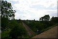
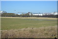
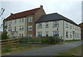
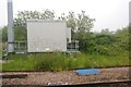
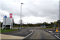
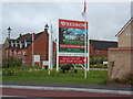
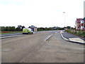
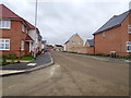
42 photos from this area
Area Information
Key information about the CB7 4PJ including its size, population, and administrative classification.
- Area Type
- Postcode
- Area Size
- 2.3 hectares
- Population
- 1535
- Population Density
- 4944 people/km²
House Prices in CB7 4PJ
65
Properties
£221,905
Average Sold Price
£118,000
Lowest Price
£400,000
Highest Price
Showing 65 properties
| Address | Type | Beds | Baths | Last Sale Price | Last Sale Date | |
|---|---|---|---|---|---|---|
| 278 Kings Avenue, Ely, CB7 4PJ | Terraced | 3 | 1 | £285,500 | Jun 2025 | |
| 256 Kings Avenue, Ely, CB7 4PJ | Semi-detached | 3 | 2 | £335,000 | Dec 2024 | |
| 234 Kings Avenue, Ely, CB7 4PJ | Terraced | 3 | 1 | £335,000 | May 2024 | |
| 238 Kings Avenue, Ely, CB7 4PJ | Terraced | 2 | 1 | £256,000 | Oct 2023 | |
| 174 Kings Avenue, Ely, CB7 4PJ | Flat | 4 | 3 | £155,000 | Apr 2023 | |
| 230 Kings Avenue, Ely, CB7 4PJ | Terraced | 2 | 1 | £263,000 | Apr 2023 | |
| 176 Kings Avenue, Ely, CB7 4PJ | Flat | 2 | 1 | £169,000 | Sep 2022 | |
| 178 Kings Avenue, Ely, CB7 4PJ | Flat | 1 | 1 | £147,000 | Aug 2022 | |
| 268 Kings Avenue, Ely, CB7 4PJ | Terraced | 2 | 2 | £260,000 | Aug 2022 | |
| 204 Kings Avenue, Ely, CB7 4PJ | house | 4 | 2 | £340,000 | Mar 2022 |
Page 1 of 7
Energy Efficiency in CB7 4PJ
Amenities
Schools
| Rank | School | Type | Entry gender | Ages |
|---|
Explore more schools in this area
Go to Schools tabDemographics
Household Size
Two person
most common
Accommodation Type
Houses
most common
Tenure
71
majority
Ethnic Group
White
most common
Religion
N/A
most common
Household Composition
N/A
most common
Age
47
median
Adults (30-64 years)
most common
Household Deprivation
N/A
with no deprivation
NS-SEC
52
in Lower managerial occupations
Explore more demographic insights in this area
Go to Demographics tabPlanning
Planning Constraints
- Flood RiskPremium
- Ramsar Wetland SitesPremium
- Area of Outstanding Natural BeautyPremium
- Protected Nature ReservePremium
- Protected WoodlandPremium