Area Overview for CB6 3RY
Photos of CB6 3RY
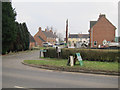
10 photos from this area
Area Information
Key information about the CB6 3RY including its size, population, and administrative classification.
- Area Type
- Postcode
- Area Size
- 1.1 km²
- Population
- 1808
- Population Density
- 88 people/km²
House Prices in CB6 3RY
15
Properties
£329,063
Average Sold Price
£145,000
Lowest Price
£625,000
Highest Price
Showing 15 properties
| Address | Type | Beds | Baths | Last Sale Price | Last Sale Date | |
|---|---|---|---|---|---|---|
| 105 Stretham Road, Wilburton, CB6 3RY | house | - | - | £200,000 | Dec 2021 | |
| 91 Stretham Road, Wilburton, CB6 3RY | Detached | 4 | 3 | £625,000 | Dec 2021 | |
| Flexon House, 93 Stretham Road, Wilburton, CB6 3RY | office_workshop | 5 | - | £580,000 | Dec 2020 | |
| 95A Stretham Road, Wilburton, CB6 3RY | Detached | 4 | 2 | £520,500 | May 2020 | |
| 103 Stretham Road, Wilburton, CB6 3RY | Semi-detached | 3 | - | £175,000 | Oct 2013 | |
| 101 Stretham Road, Wilburton, CB6 3RY | Semi-detached | 3 | - | £180,000 | May 2013 | |
| 99 Stretham Road, Wilburton, CB6 3RY | house | 3 | - | £207,000 | Sep 2010 | |
| Glenholm, 89 Stretham Road, Wilburton, CB6 3RY | Detached | 6 | 4 | £145,000 | Jun 2004 | |
| 100 Stretham Road, Wilburton, CB6 3RY | Bungalow | 4 | 3 | - | - | |
| Barton House, 95B Stretham Road, Wilburton, CB6 3RY | Detached | 4 | 2 | - | - |
Page 1 of 2
Energy Efficiency in CB6 3RY
Amenities
Schools
| Rank | School | Type | Entry gender | Ages |
|---|
Explore more schools in this area
Go to Schools tabDemographics
Household Size
Two person
most common
Accommodation Type
Houses
most common
Tenure
72
majority
Ethnic Group
White
most common
Religion
N/A
most common
Household Composition
N/A
most common
Age
47
median
Adults (30-64 years)
most common
Household Deprivation
N/A
with no deprivation
NS-SEC
39
in Lower managerial occupations
Explore more demographic insights in this area
Go to Demographics tabPlanning
Planning Constraints
- Flood RiskPremium
- Ramsar Wetland SitesPremium
- Area of Outstanding Natural BeautyPremium
- Protected Nature ReservePremium
- Protected WoodlandPremium