Area Overview for CB6 3JQ
Photos of CB6 3JQ
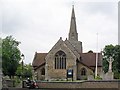
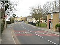
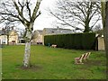
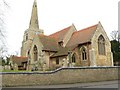
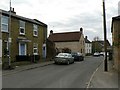
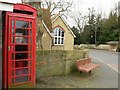
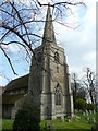
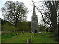
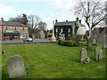
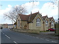
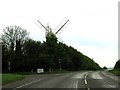
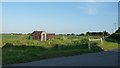
63 photos from this area
Area Information
Key information about the CB6 3JQ including its size, population, and administrative classification.
- Area Type
- Postcode
- Area Size
- 4.1 hectares
- Population
- 1808
- Population Density
- 88 people/km²
House Prices in CB6 3JQ
31
Properties
£310,437
Average Sold Price
£114,250
Lowest Price
£825,000
Highest Price
Showing 31 properties
| Address | Type | Beds | Baths | Last Sale Price | Last Sale Date | |
|---|---|---|---|---|---|---|
| 28 High Street, Stretham, CB6 3JQ | house | - | - | £270,000 | Aug 2025 | |
| 8 High Street, Stretham, CB6 3JQ | Terraced | 2 | 1 | £230,000 | Sep 2024 | |
| 26 High Street, Stretham, CB6 3JQ | Bungalow | 3 | 2 | £525,000 | Mar 2023 | |
| 14 High Street, Stretham, CB6 3JQ | house | 2 | 1 | £200,000 | Feb 2021 | |
| Spring Cottage, 20 High Street, Stretham, CB6 3JQ | Semi-detached | 4 | 2 | £310,000 | Feb 2019 | |
| 6 High Street, Stretham, CB6 3JQ | Terraced | 4 | 2 | £400,000 | Aug 2018 | |
| Barn Owls, 21 High Street, Stretham, CB6 3JQ | Semi-detached | 4 | - | £450,000 | Feb 2018 | |
| 20A High Street, Stretham, CB6 3JQ | Detached | 4 | 2 | £435,000 | Jun 2017 | |
| 3 High Street, Stretham, CB6 3JQ | Semi-detached | 2 | 1 | £221,000 | Jun 2017 | |
| 2 High Street, Stretham, CB6 3JQ | Detached | 3 | - | £485,000 | Nov 2013 |
Page 1 of 4
Energy Efficiency in CB6 3JQ
Amenities
Schools
| Rank | School | Type | Entry gender | Ages |
|---|
Explore more schools in this area
Go to Schools tabDemographics
Household Size
Two person
most common
Accommodation Type
Houses
most common
Tenure
72
majority
Ethnic Group
White
most common
Religion
N/A
most common
Household Composition
N/A
most common
Age
47
median
Adults (30-64 years)
most common
Household Deprivation
N/A
with no deprivation
NS-SEC
39
in Lower managerial occupations
Explore more demographic insights in this area
Go to Demographics tabPlanning
Planning Constraints
- Flood RiskPremium
- Ramsar Wetland SitesPremium
- Area of Outstanding Natural BeautyPremium
- Protected Nature ReservePremium
- Protected WoodlandPremium