Area Overview for CB6 2TZ
Photos of CB6 2TZ
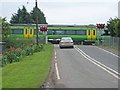
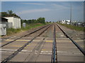
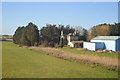
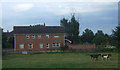
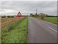
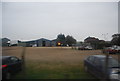
18 photos from this area
Area Information
Key information about the CB6 2TZ including its size, population, and administrative classification.
- Area Type
- Postcode
- Area Size
- 80.0 hectares
- Population
- 1561
- Population Density
- 29 people/km²
House Prices in CB6 2TZ
9
Properties
£204,000
Average Sold Price
£100,000
Lowest Price
£320,000
Highest Price
Showing 9 properties
| Address | Type | Beds | Baths | Last Sale Price | Last Sale Date | |
|---|---|---|---|---|---|---|
| Suillean, 7 Black Bank Road, Little Downham, CB6 2TZ | Detached | - | - | £320,000 | Aug 2004 | |
| Milkiway Ice Cream, Ile Farmhouse, 5 Black Bank Road, Little Downham, CB6 2TZ | house | - | - | £192,000 | Aug 2003 | |
| 2 Black Bank Road, Little Downham, CB6 2TZ | Detached | - | - | £100,000 | Mar 1999 | |
| 3 BLACK BANK ROAD, Little Downham, CB6 2TZ | Detached | - | - | - | - | |
| Bank House, 1 Black Bank Road, Little Downham, CB6 2TZ | Detached | - | - | - | - | |
| Esk Hause, 4 Black Bank Road, Little Downham, CB6 2TZ | house | - | - | - | - | |
| Paddock Lodge, 2A Black Bank Road, Little Downham, CB6 2TZ | house | - | - | - | - | |
| Criteria Cars (uk) Ltd, Black Bank Road, Little Downham, CB6 2TZ | shop | - | - | - | - | |
| Prontocold (refrigeration) Ltd, Black Bank Station, Black Bank Road, Little Downham, CB6 2TZ | Industrial | - | - | - | - |
Energy Efficiency in CB6 2TZ
Amenities
Schools
| Rank | School | Type | Entry gender | Ages |
|---|
Explore more schools in this area
Go to Schools tabDemographics
Household Size
Family (3-5 people)
most common
Accommodation Type
Houses
most common
Tenure
85
majority
Ethnic Group
White
most common
Religion
N/A
most common
Household Composition
N/A
most common
Age
47
median
Adults (30-64 years)
most common
Household Deprivation
N/A
with no deprivation
NS-SEC
37
in Lower managerial occupations
Explore more demographic insights in this area
Go to Demographics tabPlanning
Planning Constraints
- Flood RiskPremium
- Ramsar Wetland SitesPremium
- Area of Outstanding Natural BeautyPremium
- Protected Nature ReservePremium
- Protected WoodlandPremium