Area Overview for CB6 2JB
Photos of CB6 2JB
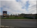
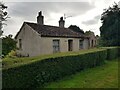
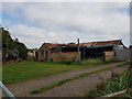
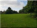
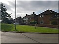
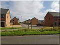
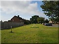
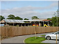
38 photos from this area
Area Information
Key information about the CB6 2JB including its size, population, and administrative classification.
- Area Type
- Postcode
- Area Size
- 3.1 hectares
- Population
- 1303
- Population Density
- 177 people/km²
House Prices in CB6 2JB
51
Properties
£185,339
Average Sold Price
£28,975
Lowest Price
£345,000
Highest Price
Showing 51 properties
| Address | Type | Beds | Baths | Last Sale Price | Last Sale Date | |
|---|---|---|---|---|---|---|
| 18 Manor Close, Witchford, CB6 2JB | Bungalow | 2 | 1 | £317,500 | Dec 2024 | |
| 47 Manor Close, Witchford, CB6 2JB | Retail | 3 | - | £345,000 | Apr 2022 | |
| 45A Manor Close, Witchford, CB6 2JB | Bungalow | 2 | 1 | £300,000 | Mar 2022 | |
| 21 Manor Close, Witchford, CB6 2JB | Bungalow | - | - | £270,000 | Jun 2021 | |
| 25 Manor Close, Witchford, CB6 2JB | Bungalow | - | - | £185,000 | Oct 2019 | |
| 11 Manor Close, Witchford, CB6 2JB | Terraced | 4 | 1 | £240,000 | Apr 2019 | |
| 13 Manor Close, Witchford, CB6 2JB | Terraced | 3 | - | £170,000 | Feb 2019 | |
| 29 Manor Close, Witchford, CB6 2JB | Semi-detached | 3 | 1 | £279,000 | Dec 2017 | |
| 37 Manor Close, Witchford, CB6 2JB | Terraced | 3 | 1 | £248,000 | Apr 2017 | |
| 44 Manor Close, Witchford, CB6 2JB | house | - | - | £215,000 | Dec 2014 |
Page 1 of 6
Energy Efficiency in CB6 2JB
Amenities
Schools
| Rank | School | Type | Entry gender | Ages |
|---|
Explore more schools in this area
Go to Schools tabDemographics
Household Size
Two person
most common
Accommodation Type
Houses
most common
Tenure
80
majority
Ethnic Group
White
most common
Religion
N/A
most common
Household Composition
N/A
most common
Age
47
median
Adults (30-64 years)
most common
Household Deprivation
N/A
with no deprivation
NS-SEC
32
in Lower managerial occupations
Explore more demographic insights in this area
Go to Demographics tabPlanning
Planning Constraints
- Flood RiskPremium
- Ramsar Wetland SitesPremium
- Area of Outstanding Natural BeautyPremium
- Protected Nature ReservePremium
- Protected WoodlandPremium