Area Overview for CB6 2ED
Photos of CB6 2ED
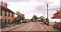

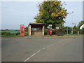
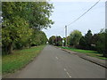
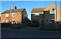
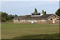
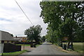
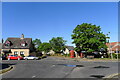
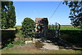

32 photos from this area
Area Information
Key information about the CB6 2ED including its size, population, and administrative classification.
- Area Type
- Postcode
- Area Size
- 11.5 hectares
- Population
- 1561
- Population Density
- 29 people/km²
House Prices in CB6 2ED
36
Properties
£232,318
Average Sold Price
£47,000
Lowest Price
£425,000
Highest Price
Showing 36 properties
| Address | Type | Beds | Baths | Last Sale Price | Last Sale Date | |
|---|---|---|---|---|---|---|
| 2 Main Street, Pymoor, CB6 2ED | house | 4 | 3 | £425,000 | Jul 2025 | |
| 41 Main Street, Pymoor, CB6 2ED | Bungalow | 2 | 1 | £328,000 | Oct 2024 | |
| 1 Main Street, Pymoor, CB6 2ED | Semi-detached | 3 | 1 | £220,000 | Apr 2024 | |
| 2A Main Street, Pymoor, CB6 2ED | Bungalow | - | - | £185,000 | Mar 2022 | |
| 14 Main Street, Pymoor, CB6 2ED | house | - | - | £425,000 | Mar 2022 | |
| 39 Main Street, Pymoor, CB6 2ED | Detached | 4 | 2 | £360,000 | Nov 2020 | |
| 37 Main Street, Pymoor, CB6 2ED | Bungalow | - | - | £317,500 | Mar 2019 | |
| 25 Main Street, Pymoor, CB6 2ED | Semi-detached | 2 | 1 | £227,000 | Aug 2018 | |
| Formidarbla, 3 Main Street, Pymoor, CB6 2ED | house | 3 | - | £239,950 | Jan 2017 | |
| 33 Main Street, Pymoor, CB6 2ED | Semi-detached | 2 | 1 | £167,000 | Dec 2015 |
Page 1 of 4
Energy Efficiency in CB6 2ED
Amenities
Schools
| Rank | School | Type | Entry gender | Ages |
|---|
Explore more schools in this area
Go to Schools tabDemographics
Household Size
Family (3-5 people)
most common
Accommodation Type
Houses
most common
Tenure
85
majority
Ethnic Group
White
most common
Religion
N/A
most common
Household Composition
N/A
most common
Age
47
median
Adults (30-64 years)
most common
Household Deprivation
N/A
with no deprivation
NS-SEC
37
in Lower managerial occupations
Explore more demographic insights in this area
Go to Demographics tabPlanning
Planning Constraints
- Flood RiskPremium
- Ramsar Wetland SitesPremium
- Area of Outstanding Natural BeautyPremium
- Protected Nature ReservePremium
- Protected WoodlandPremium