Area Overview for CB6 1XN
Photos of CB6 1XN


Area Information
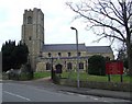
Living in CB6 1XN, a small residential cluster in East Cambridgeshire, offers a blend of historical charm and practical modernity. Nestled six miles north of Ely along the River Great Ouse, the area is steeped in history, from its Domesday Book origins to the 1816 Littleport Riots. With a population of 2,286 spread over 9.6 km², the community feels close-knit, with a median age of 47 and a predominance of homeowners (73%). The area’s character is shaped by its proximity to natural features like Burnt Fen and Mare Fen, alongside landmarks such as the Harley-Davidson statue and the Grade II-listed Adams Heritage Centre. Daily life here balances quiet rural living with access to nearby towns via the A10 road and rail links. Residents benefit from a stable, mature demographic, with a focus on family-oriented living, reflected in the presence of Millfield Primary School and a range of local amenities within practical reach. CB6 1XN is ideal for those seeking a peaceful yet connected lifestyle, where history and convenience coexist.
- Area Type
- Postcode
- Area Size
- Not available
- Population
- 2286
- Population Density
- 238 people/km²
The property market in CB6 1XN is dominated by owner-occupied homes, with 73% of properties in private hands. The area is primarily composed of houses rather than flats, indicating a housing stock suited to families and long-term residents. This suggests a market that prioritises stability over rental turnover, with limited pressure from short-term lettings. The small size of the postcode area means the housing stock is concentrated, offering buyers a focused selection of properties. Given the high homeownership rate and the absence of large-scale development, the market is likely to be competitive for those seeking a home in this specific cluster. For buyers, this environment may present opportunities for purchasing a family home in a low-density, historically rich setting, though the limited size of the area means proximity to amenities and transport is a key consideration.
House Prices in CB6 1XN
No properties found in this postcode.
Energy Efficiency in CB6 1XN
The lifestyle in CB6 1XN is supported by a range of local amenities within practical reach. Retail options include five venues such as Co-op Main, Co-op Wisbech, and M&S Littleport BP, offering everyday shopping needs. The area’s proximity to rail stations—Littleport, Ely, and Shippea Hill—ensures easy access to regional services and employment opportunities. While parks and leisure facilities are not explicitly named in the data, the historical and natural surroundings, including the River Great Ouse and nearby fens, suggest opportunities for outdoor activities. The presence of a well-rated primary school and retail options contributes to a convenient, family-friendly environment. Residents benefit from a balance of local convenience and access to broader networks, making daily life both practical and connected.
Amenities
Schools
The nearest school to CB6 1XN is Millfield Primary School, which serves the local community with a primary education offering. The school holds a ‘good’ Ofsted rating, reflecting its quality of teaching and student outcomes. As the only named school in the data, it is the primary educational institution for young families in the area. The absence of secondary schools nearby means parents may need to consider commuting to Ely or other nearby towns for secondary education. However, the presence of a well-rated primary school supports the area’s appeal to families, ensuring children have access to a solid foundation in early education. The school’s rating suggests it meets or exceeds national standards, which is a significant factor for homebuyers prioritising quality schooling.
| Rank | School | Type | Entry gender | Ages |
|---|
Explore more schools in this area
Go to Schools tabDemographics
The community in CB6 1XN is predominantly composed of adults aged 30–64, with a median age of 47. Homeownership is high at 73%, indicating a stable, long-term resident base. The area is characterised by a predominance of houses rather than flats, reflecting a traditional, family-focused housing stock. The majority of residents identify as White, though specific data on other ethnic groups is not provided. The population density of 238 people per km² suggests a low-rise, spread-out settlement pattern. This demographic profile aligns with a mature, established community where most households are owner-occupied, contributing to a sense of permanence. The absence of detailed diversity statistics means the area’s social fabric is largely defined by its core demographic, though the presence of historical sites and local amenities suggests a welcoming environment for new residents.
Household Size
Accommodation Type
Tenure
Ethnic Group
Religion
Household Composition
Age
Household Deprivation
NS-SEC
Explore more demographic insights in this area
Go to Demographics tabPlanning
Planning Constraints
- Flood RiskPremium
- Ramsar Wetland SitesPremium
- Area of Outstanding Natural BeautyPremium
- Protected Nature ReservePremium
- Protected WoodlandPremium