Area Overview for CB6 1SR
Photos of CB6 1SR


Area Information
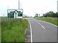
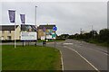
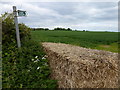
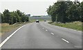
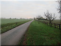
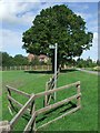
Living in CB6 1SR means being part of a tight-knit residential cluster in East Cambridgeshire, where the population of 2,286 people spreads across 238 people per square kilometre. This small area, part of the village of Littleport, sits six miles north of Ely, near the River Great Ouse. The community is shaped by its history, from medieval origins tied to the Abbey of Ely to the 1816 riots that left a mark on St George’s Church. Today, it balances rural charm with practical connectivity. Residents benefit from proximity to Littleport Railway Station and the A10 road, while the area’s low crime score of 79/100 underscores its safety. The presence of the Adams Heritage Centre, a Grade II-listed ironmonger’s shop, and the Harley-Davidson statue adds character. CB6 1SR is ideal for those seeking a quieter, family-oriented lifestyle with access to nearby towns and amenities.
- Area Type
- Postcode
- Area Size
- Not available
- Population
- 2286
- Population Density
- 238 people/km²
CB6 1SR is primarily an owner-occupied area, with 73% of homes owned by residents rather than rented. The housing stock is dominated by houses, which is typical for smaller rural clusters where larger properties are more common. This suggests a market where buyers are likely to seek long-term investment rather than short-term rental opportunities. The small size of the area means the housing stock is limited, and properties are likely to be in close proximity to local amenities and transport links. For buyers, this presents both challenges and advantages: while the selection is restricted, the emphasis on owner-occupation and traditional housing types may appeal to those prioritising stability and space. Proximity to Littleport’s rail network and nearby towns like Ely also enhances the area’s appeal for commuters.
House Prices in CB6 1SR
No properties found in this postcode.
Energy Efficiency in CB6 1SR
Residents of CB6 1SR have access to a range of nearby amenities, including five retail outlets such as Co-op Main, Co-op Wisbech, and M&S Littleport BP. These shops provide everyday convenience for groceries, clothing, and fuel. The area’s rail network, with stations at Littleport, Ely, and Shippea Hill, connects residents to broader regional services. Historically, the village is home to the Adams Heritage Centre, a Grade II-listed ironmonger’s shop with original features, and the lowest trig point in Britain near Little Ouse. These landmarks add character to daily life, blending practicality with heritage. The mix of retail, transport, and historical sites ensures a lifestyle that balances rural tranquillity with modern convenience.
Amenities
Schools
The nearest school to CB6 1SR is Millfield Primary School, which serves the local community with a primary education offering. The school holds an Ofsted rating of ‘good’, reflecting its quality of teaching and student outcomes. As the only named school in the immediate area, it is a critical factor for families considering the area. The absence of secondary schools nearby means students may need to travel to Ely or other nearby towns for further education. However, the presence of a well-regarded primary school supports the area’s appeal to families seeking a stable, locally rooted education system. The school’s rating indicates that it meets or exceeds national standards, providing reassurance for prospective residents.
| Rank | School | Type | Entry gender | Ages |
|---|---|---|---|---|
| 1 | Millfield Primary School | primary | N/A | N/A |
| 2 | Millfield Primary School | primary | N/A | N/A |
Explore more schools in this area
Go to Schools tabDemographics
The population of CB6 1SR has a median age of 47, with the majority of residents aged 30–64. This suggests a mature, stable community, likely with established families and professionals. Home ownership is high at 73%, indicating a preference for long-term residency over rental properties. The area is predominantly composed of houses, reflecting a traditional, low-density housing stock. The predominant ethnic group is White, aligning with broader trends in rural England. While specific deprivation data is not provided, the high home ownership and low crime risk suggest a relatively affluent and secure environment. The demographic profile indicates a community focused on stability, with limited turnover and a strong sense of local identity.
Household Size
Accommodation Type
Tenure
Ethnic Group
Religion
Household Composition
Age
Household Deprivation
NS-SEC
Explore more demographic insights in this area
Go to Demographics tabPlanning
Planning Constraints
- Flood RiskPremium
- Ramsar Wetland SitesPremium
- Area of Outstanding Natural BeautyPremium
- Protected Nature ReservePremium
- Protected WoodlandPremium
- Crime RiskPremium