Area Overview for CB6 1NJ
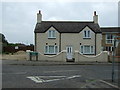
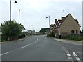
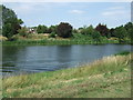
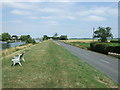
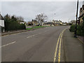
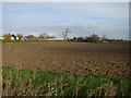
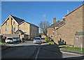
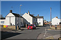
Photos of CB6 1NJ
Area Information
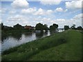
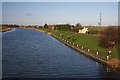
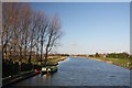
Living in CB6 1NJ means being part of a small, tightly knit residential cluster in East Cambridgeshire. The area covers 2,068 square metres and is home to 2,286 people, giving it a population density of 238 people per square kilometre. This is a village with a distinct character, rooted in its history as a civil parish near the River Great Ouse. The postcode lies six miles north of Ely, with easy access to nearby towns and natural landmarks like Burnt Fen and Mare Fen. Daily life here is shaped by its proximity to the A10 road and Littleport railway station, which connects to Ely, Cambridge, and beyond. The area’s low crime risk and absence of environmental constraints make it appealing for families and professionals. Its blend of historical significance, practical transport links, and a community skewed toward adults aged 30–64 creates a stable, low-maintenance environment. Whether you’re drawn to the village’s heritage or its modern amenities, CB6 1NJ offers a quiet, accessible lifestyle with a strong sense of local identity.
- Area Type
- Postcode
- Area Size
- 2068 m²
- Population
- 2286
- Population Density
- 238 people/km²
The property market in CB6 1NJ is characterised by a high rate of home ownership—73%—indicating that most residents are long-term homeowners rather than renters. The area is predominantly composed of houses, which is typical for smaller rural or semi-rural postcodes. This suggests a housing stock that prioritises privacy, space, and traditional family homes over flats or apartments. The small size of the area—just 2,068 square metres—means that property availability is limited, and the surrounding region likely offers more options for buyers seeking similar characteristics. For those considering a move, the high home ownership rate and absence of planning constraints (such as protected woodlands or AONBs) make CB6 1NJ an attractive choice for those seeking a stable, low-risk investment. The market is likely competitive, with properties holding value due to the area’s safety, transport links, and historical appeal.
House Prices in CB6 1NJ
Showing 7 properties
| Address | Type | Beds | Baths | Last Sale Price | Last Sale Date | |
|---|---|---|---|---|---|---|
| 1 Thoroughfare Way, Littleport, CB6 1NJ | Semi-detached | 4 | 1 | £155,500 | Jul 2015 | |
| 4 Thoroughfare Way, Littleport, CB6 1NJ | Terraced | 3 | 1 | £124,950 | Sep 2013 | |
| 3 Thoroughfare Way, Littleport, CB6 1NJ | Semi-detached | 2 | 1 | £134,000 | Oct 2007 | |
| 7 Thoroughfare Way, Littleport, CB6 1NJ | house | - | - | £182,500 | Aug 2007 | |
| 6 Thoroughfare Way, Littleport, CB6 1NJ | Terraced | - | - | £52,000 | Sep 1997 | |
| 5 Thoroughfare Way, Littleport, CB6 1NJ | house | 4 | 1 | £48,500 | Aug 1996 | |
| 2 Thoroughfare Way, Littleport, CB6 1NJ | Terraced | 2 | - | - | - |
Energy Efficiency in CB6 1NJ
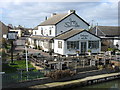
The lifestyle in CB6 1NJ is shaped by its proximity to local amenities and historical landmarks. Nearby retail options include Co-op Main, Co-op Wisbech, and M&S Littleport BP, providing essential shopping and services. The three railway stations—Littleport, Shippea Hill, and Ely—offer easy access to larger towns for more extensive shopping or dining. While the area itself has limited leisure facilities, its connection to the River Great Ouse and nearby nature reserves like Burnt Fen and Mare Fen offers opportunities for outdoor activities. The village’s historical sites, such as the Adams Heritage Centre (a Grade II-listed ironmonger’s shop) and the Harley-Davidson statue, add cultural depth to daily life. The low population density ensures a quieter, less crowded environment, ideal for those seeking a balance between convenience and tranquillity.
Amenities
Schools
The nearest school to CB6 1NJ is Millfield Primary School, which provides education for younger children. The school is rated ‘good’ by Ofsted, indicating a solid standard of teaching and facilities. This single primary school serves the local community, offering a straightforward option for families with young children. The absence of secondary schools in the immediate area means that students may need to travel to nearby towns like Ely or Wisbech for further education. However, the ‘good’ rating at Millfield Primary suggests that the area is well-served for early years education, reducing the need for long commutes. For families prioritising strong primary schooling, this is a positive factor. The limited range of school types reflects the small size of the area, but the quality of the existing school provides reassurance for parents.
| Rank | School | Type | Entry gender | Ages |
|---|
Explore more schools in this area
Go to Schools tabDemographics
The community in CB6 1NJ is predominantly composed of adults aged 30–64, with a median age of 47. This suggests a mature, settled population, likely with established careers and families. Home ownership is high at 73%, indicating a strong preference for long-term residency rather than rental properties. The area is largely made up of houses, reflecting a suburban or semi-rural character. The predominant ethnic group is White, though specific data on diversity is not provided. The population density of 238 people per square kilometre is relatively low, contributing to a less congested, more private living experience. This demographic profile suggests a community focused on stability and comfort, with fewer transient residents. The absence of detailed deprivation data means the area’s quality of life is inferred from its low crime risk and lack of environmental constraints, which align with a generally secure and manageable lifestyle.
Household Size
Accommodation Type
Tenure
Ethnic Group
Religion
Household Composition
Age
Household Deprivation
NS-SEC
Explore more demographic insights in this area
Go to Demographics tabPlanning
Planning Constraints
- Flood RiskPremium
- Ramsar Wetland SitesPremium
- Area of Outstanding Natural BeautyPremium
- Protected Nature ReservePremium
- Protected WoodlandPremium