Area Overview for CB6 1GE
Photos of CB6 1GE


Area Information
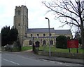
CB6 1GE is a compact residential cluster in East Cambridgeshire, encompassing the village of Littleport and surrounding areas. With a population of 1,793 spread over 1.4 hectares, it is a densely populated yet intimate community. The area’s history is steeped in local lore, from its Domesday Book origins to the 1816 riots and its ties to figures like William Harley, the father of Harley-Davidson. Today, residents benefit from proximity to the River Great Ouse and the A10 road, blending historical charm with modern convenience. The village’s character is defined by its mix of traditional architecture and practical amenities, such as the Grade II-listed Adams Heritage Centre. Living here offers a quiet, close-knit environment, ideal for those seeking a balance between rural tranquillity and accessible services. The low flood risk and strong safety profile further enhance its appeal, making it a viable choice for families and professionals alike.
- Area Type
- Postcode
- Area Size
- 1.4 hectares
- Population
- 1793
- Population Density
- 1716 people/km²
The property market in CB6 1GE is characterised by high home ownership (74%) and a focus on houses rather than flats or apartments. This suggests a predominantly owner-occupied area, with limited rental stock. The small size of the postcode area (1.4 hectares) means housing stock is likely limited, potentially leading to competition among buyers. The concentration of houses may indicate a preference for family homes, though the lack of data on property types beyond “houses” means specifics about availability or size are unclear. For buyers, this area’s compact nature means proximity to amenities is key, with residents relying on nearby towns like Ely for broader services. The high home ownership rate also suggests long-term residency, which may influence property values and market stability.
House Prices in CB6 1GE
Showing 21 properties
| Address | Type | Beds | Baths | Last Sale Price | Last Sale Date | |
|---|---|---|---|---|---|---|
| 26 Dexter Lane, Littleport, CB6 1GE | Detached | 3 | 3 | £299,995 | Jul 2025 | |
| 28 Dexter Lane, Littleport, CB6 1GE | Semi-detached | 3 | 2 | £280,000 | Oct 2024 | |
| 12 Dexter Lane, Littleport, CB6 1GE | Detached | 4 | 2 | £372,500 | May 2024 | |
| 5 Dexter Lane, Littleport, CB6 1GE | Semi-detached | 3 | - | £249,950 | Jun 2021 | |
| 32 Dexter Lane, Littleport, CB6 1GE | Semi-detached | 3 | 2 | £245,000 | May 2021 | |
| 24 Dexter Lane, Littleport, CB6 1GE | house | - | - | £230,000 | Mar 2021 | |
| 4 Dexter Lane, Littleport, CB6 1GE | Detached | 4 | 2 | £415,000 | Jun 2020 | |
| 8 Dexter Lane, Littleport, CB6 1GE | Detached | 4 | 3 | £410,000 | Apr 2020 | |
| 16 Dexter Lane, Littleport, CB6 1GE | house | 3 | 2 | £245,000 | Jan 2018 | |
| 20 Dexter Lane, Littleport, CB6 1GE | house | - | - | £185,000 | Dec 2014 |
Energy Efficiency in CB6 1GE
The lifestyle in CB6 1GE is shaped by its proximity to retail and transport hubs. Nearby amenities include Co-op Main, Co-op Wisbech, and M&S Littleport BP, offering essential shopping and dining options. The rail network provides access to Ely and other towns, facilitating both commuting and leisure travel. The area’s historical sites, such as the Adams Heritage Centre and the Harley-Davidson statue, add cultural value, while the A10 road connects residents to broader regional attractions. Daily life is characterised by a blend of practicality and heritage, with residents able to enjoy local shops, efficient transport, and the village’s historical charm. The compact nature of the area means amenities are within easy reach, though larger retail or entertainment options may require travel to nearby centres.
Amenities
Schools
The nearest school to CB6 1GE is Littleport Community Primary School, which holds an Ofsted rating of “good.” This school serves the local primary education needs of the area, offering a foundation for families with young children. However, the data does not include secondary schools or other educational institutions, meaning parents may need to consider commuting to nearby towns for secondary education. The presence of a well-rated primary school is a positive factor, but the absence of comprehensive schooling within the immediate vicinity could be a consideration for families planning long-term residency. The school’s rating indicates a satisfactory standard of education, though further research would be necessary to assess its curriculum and extracurricular offerings.
| Rank | School | Type | Entry gender | Ages |
|---|
Explore more schools in this area
Go to Schools tabDemographics
The population of CB6 1GE is predominantly adults aged 30–64, with a median age of 47. This suggests a mature, stable community, likely composed of long-term residents and families. Home ownership is high at 74%, with houses being the primary accommodation type. The predominant ethnic group is White, reflecting the area’s historical and cultural continuity. The population density of 1,716 people per square kilometre indicates a tightly knit neighbourhood, where social interactions are frequent. While no specific data on deprivation is provided, the high home ownership and low crime risk imply a generally secure and self-sufficient community. The absence of significant demographic diversity may appeal to those seeking a homogenous, familiar environment, though it also means the area’s cultural and social dynamics are relatively uniform.
Household Size
Accommodation Type
Tenure
Ethnic Group
Religion
Household Composition
Age
Household Deprivation
NS-SEC
Explore more demographic insights in this area
Go to Demographics tabPlanning
Planning Constraints
- Flood RiskPremium
- Ramsar Wetland SitesPremium
- Area of Outstanding Natural BeautyPremium
- Protected Nature ReservePremium
- Protected WoodlandPremium