Area Overview for CB6 1EJ
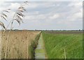
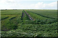
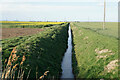
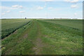
Photos of CB6 1EJ
Area Information
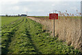
Living in CB6 1EJ means being part of a small, tightly knit residential cluster in East Cambridgeshire, just six miles north of Ely. The area spans 4.2 km² and is home to 1,365 residents, creating a low-density, community-focused environment. With a median age of 47, the population skews toward adults aged 30–64, reflecting a stable, established demographic. The village’s history is steeped in local lore, from its 11th-century origins to the 1816 riots and its connection to the Harley-Davidson legacy. Daily life here balances quiet rural charm with practical amenities, including two railway stations and proximity to the A10 road. While the area lacks dense urban infrastructure, its compact size ensures a sense of familiarity and accessibility. Residents benefit from a mix of historical sites, such as the Grade II-listed Adams Heritage Centre, and modern conveniences like nearby supermarkets and schools. The low population density and older age profile suggest a community prioritising stability over rapid change, making it appealing to those seeking a slower pace of life.
- Area Type
- Postcode
- Area Size
- 4.2 km²
- Population
- 1365
- Population Density
- 60 people/km²
The property market in CB6 1EJ is characterised by high home ownership (69%) and a predominance of houses, reflecting a residential area tailored to families and long-term occupants. With a population of 1,365 spread over 4.2 km², the housing stock is unlikely to include high-density developments or rental-focused properties. This suggests a market where properties are typically owner-occupied, with limited turnover. The scarcity of data on property types or prices means buyers should consider the area’s small size and proximity to amenities like schools and rail links. The focus on houses implies a preference for private, spacious living, which may appeal to those prioritising family-friendly environments. However, the limited scale of the area means the immediate surroundings are critical for assessing property value growth, as CB6 1EJ itself is a small, self-contained postcode.
House Prices in CB6 1EJ
Showing 23 properties
| Address | Type | Beds | Baths | Last Sale Price | Last Sale Date | |
|---|---|---|---|---|---|---|
| 30 Hale Fen, Littleport, CB6 1EJ | house | - | - | £285,000 | Mar 2025 | |
| Bethel Cottage, 19 Hale Fen, Littleport, CB6 1EJ | Semi-detached | 3 | 1 | £260,000 | Mar 2025 | |
| The Corner Cottage, 33A Hale Fen, Littleport, CB6 1EJ | Detached | 3 | 1 | £170,000 | Jul 2021 | |
| 31 Hale Fen, Littleport, CB6 1EJ | Detached | 3 | 1 | £187,500 | Aug 2016 | |
| Witsend, 32 Hale Fen, Littleport, CB6 1EJ | house | 2 | - | £125,000 | Dec 2013 | |
| 28 Hale Fen, Littleport, CB6 1EJ | Semi-detached | 3 | - | £150,000 | Sep 2013 | |
| 18 Hale Fen, Littleport, CB6 1EJ | Semi-detached | - | - | £119,950 | Sep 2004 | |
| 20 Hale Fen, Littleport, CB6 1EJ | Semi-detached | - | - | £117,500 | Apr 2004 | |
| Dilamore Hill Farmhouse, 36 Hale Fen, Littleport, CB6 1EJ | Detached | - | - | £175,000 | Nov 2001 | |
| The Stables, 33 Hale Fen, Littleport, CB6 1EJ | Semi-detached | - | - | £55,000 | Feb 2000 |
Energy Efficiency in CB6 1EJ
The lifestyle in CB6 1EJ is shaped by its small size and proximity to essential amenities. Nearby retail options include M&S Littleport BP, Co-op Wisbech, and Co-op Main, providing access to grocery and general shopping. The two railway stations—Littleport and Manea—offer convenient transport links to regional centres. While the area lacks large-scale leisure facilities, its historical sites, such as the Adams Heritage Centre, add cultural value. The low population density means a quieter, more intimate environment, with daily life centred around local shops, schools, and transport hubs. Residents benefit from a balance between rural tranquillity and practical connectivity, though the absence of parks or major recreational spaces may require travel for outdoor activities. The area’s character is defined by its accessibility to both historical landmarks and modern conveniences.
Amenities
Schools
Residents of CB6 1EJ have access to three schools within practical reach: Littleport & East Cambs Academy, a standard academy; Highfield Littleport Academy, a special school; and Vista Academy Littleport, another academy. The mix of academy and special schools suggests a range of educational options, though the absence of Ofsted ratings or performance data means parents must rely on other factors, such as proximity and school type. The presence of a special school indicates the area caters to diverse educational needs, while the academies may offer broader curricula. For families, the availability of multiple schools reduces the need to travel far, though the specific quality of education remains unquantified. The lack of grammar schools or independent institutions means the options are primarily state-run, which may influence decisions for those prioritising certain educational pathways.
| Rank | School | Type | Entry gender | Ages |
|---|
Explore more schools in this area
Go to Schools tabDemographics
The community in CB6 1EJ is predominantly composed of adults aged 30–64, with a median age of 47. This suggests a mature, settled population, likely with long-term ties to the area. Home ownership is high at 69%, indicating a strong presence of long-term residents rather than transient renters. The accommodation type is primarily houses, aligning with the area’s low population density of 60 people per km². The predominant ethnic group is White, reflecting the broader demographic patterns of rural East Cambridgeshire. With no specific data on deprivation levels, the area’s characteristics imply a community focused on stability and self-sufficiency. The age profile suggests a mix of working professionals and retirees, potentially influencing local services and amenities. The absence of significant diversity data means the community’s social dynamics remain largely homogeneous, which may appeal to those seeking a familiar, cohesive environment.
Household Size
Accommodation Type
Tenure
Ethnic Group
Religion
Household Composition
Age
Household Deprivation
NS-SEC
Explore more demographic insights in this area
Go to Demographics tabPlanning
Planning Constraints
- Flood RiskPremium
- Ramsar Wetland SitesPremium
- Area of Outstanding Natural BeautyPremium
- Protected Nature ReservePremium
- Protected WoodlandPremium