Area Overview for CB5 8UX
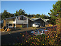
Photos of CB5 8UX


Area Information
Living in CB5 8UX means being part of a small, tightly knit residential cluster in Cambridge, where history and modernity intersect. The area covers 5,371 square metres and is home to 1,730 people, making it a densely populated yet compact community. Its roots trace back to the 20th century, when the Fen Ditton Fields housing estate was developed to meet Cambridge’s growing need for housing. Today, the area is defined by suburban layouts, ring-roads, and major routes like Newmarket Road, which connects it to the city’s east. Daily life here balances proximity to urban amenities with a sense of quiet suburbia. Residents benefit from nearby schools, retail hubs, and transport links, while the area’s low flood risk and absence of environmental constraints make it a practical choice. CB5 8UX is ideal for those seeking a manageable, well-connected slice of Cambridge life, with a focus on family-friendly infrastructure and straightforward accessibility.
- Area Type
- Postcode
- Area Size
- 5371 m²
- Population
- 1730
- Population Density
- 1107 people/km²
The property market in CB5 8UX is dominated by owner-occupied homes, with 51% of residents owning their properties. The area’s accommodation type is primarily houses, reflecting a suburban layout typical of Cambridge’s post-war housing estates. This contrasts with areas dominated by flats or rentals, making CB5 8UX a more family-oriented market. The small size of the postcode means the housing stock is limited, with no indication of high-end or luxury properties. For buyers, this suggests a focus on practical, functional homes rather than speculative investment. The proximity to transport links and schools adds to the area’s appeal, though the small size of the postcode means buyers must consider surrounding areas for more options. The market is likely stable, with properties suited to those prioritising security, established infrastructure, and ease of access to Cambridge’s amenities.
House Prices in CB5 8UX
No properties found in this postcode.
Energy Efficiency in CB5 8UX
Life in CB5 8UX is shaped by its proximity to retail, transport, and green spaces. The area’s retail options include Spar, Co-op Cambridge, and M&S Teversham BP, providing essentials and convenience for daily errands. The presence of three railway stations—Cambridge North, Waterbeach, and Shelford—ensures easy access to the city and beyond, while two airports nearby cater to travel needs. The suburban layout, with ring-roads and major routes like Newmarket Road and Wadloes Road, offers a mix of quiet residential streets and thoroughfares. A Co-op supermarket with flats above on Whitehill Road highlights the blend of retail and housing. Though the area lacks large parks, its history as a former railway corridor suggests nearby green spaces, though these are not explicitly named in the data. The lifestyle here is practical, with a focus on accessibility and local convenience over expansive leisure facilities.
Amenities
Schools
Residents of CB5 8UX have access to a range of schools, from nursery to primary education. The Fields Nursery School provides early-years education, while Priory Infant and Junior Schools cater to younger primary students. Abbey Meadows Primary School serves the local community, and The Galfrid School, an academy with a ‘good’ Ofsted rating, offers a broader curriculum. This mix of school types ensures families can plan for their children’s education from an early age, with options for both traditional and academically focused settings. The presence of a ‘good’-rated academy suggests higher educational standards, though the area lacks secondary schools, meaning students may need to commute. For families prioritising school quality, the combination of local primaries and a strong academy makes CB5 8UX a viable choice.
| Rank | School | Type | Entry gender | Ages |
|---|
Explore more schools in this area
Go to Schools tabDemographics
The community in CB5 8UX is predominantly middle-aged, with a median age of 47 and the most common age range being adults aged 30–64. Home ownership sits at 51%, indicating a mix of owner-occupied properties and rental units. The area is characterised by houses rather than flats, reflecting a preference for family homes. The predominant ethnic group is White, though specific data on diversity is not provided. With a population density of 1,107 people per square kilometre, the area is neither overcrowded nor sparse, offering a balance between urban density and residential comfort. The age profile suggests a stable, established population, likely with long-term residents and families. This demographic profile aligns with the area’s focus on schools, transport, and local amenities, which cater to the needs of working-age adults and their dependents.
Household Size
Accommodation Type
Tenure
Ethnic Group
Religion
Household Composition
Age
Household Deprivation
NS-SEC
Explore more demographic insights in this area
Go to Demographics tabPlanning
Planning Constraints
- Flood RiskPremium
- Ramsar Wetland SitesPremium
- Area of Outstanding Natural BeautyPremium
- Protected Nature ReservePremium
- Protected WoodlandPremium