Area Overview for CB5 8ST
Photos of CB5 8ST
Area Information
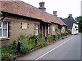
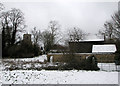
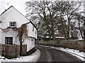
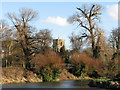
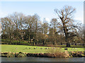
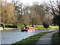
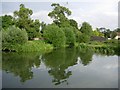
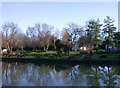
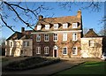
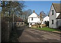
Living in CB5 8ST means inhabiting a small, residential postcode area in England’s Cambridgeshire region, nestled on the northeast edge of Cambridge. Covering 21.2 hectares and home to 1,689 residents, this area has a population density of 83 people per square kilometre, reflecting a compact, closely knit community. Its historical roots are evident in its proximity to the River Cam and the Fleam Dyke earthwork, a prehistoric defensive structure dating to the 7th century. Daily life here is shaped by its rural character, with a median age of 47 and a majority of residents aged 30–64. The area’s appeal lies in its blend of historical significance and practical amenities, including three nearby railway stations and access to primary schools. While small, CB5 8ST offers a quiet, stable environment for families and professionals seeking a balance between rural tranquillity and urban connectivity. Its low population density and limited land area suggest a focus on existing housing stock rather than expansion, making it a niche but distinct postcode to consider.
- Area Type
- Postcode
- Area Size
- 21.2 hectares
- Population
- 1689
- Population Density
- 83 people/km²
The property market in CB5 8ST is characterised by a high rate of home ownership (63%) and a predominance of houses rather than flats or apartments. This suggests a market skewed towards owner-occupied properties, likely reflecting the area’s rural and semi-rural nature. With a population density of 83 people per square kilometre and a total area of 21.2 hectares, the housing stock is limited in scale, making the area a niche market for buyers seeking established homes rather than new developments. The small land area and compact population imply that properties here are likely to be in close proximity to one another, with limited scope for expansion. For buyers, this means competition may be fierce for available homes, and the market is likely to be influenced by the area’s historical and geographical appeal. The focus on houses also indicates a preference for larger, more traditional properties, which may be more suitable for families or those prioritising space.
House Prices in CB5 8ST
Showing 49 properties
| Address | Type | Beds | Baths | Last Sale Price | Last Sale Date | |
|---|---|---|---|---|---|---|
| 32 High Street, Fen Ditton, CB5 8ST | Terraced | 2 | 1 | £385,000 | Jun 2023 | |
| 44 High Street, Fen Ditton, CB5 8ST | Terraced | 2 | 1 | £346,400 | Jan 2018 | |
| 38 High Street, Fen Ditton, CB5 8ST | Terraced | 2 | - | £319,000 | Jan 2018 | |
| 23 High Street, Fen Ditton, CB5 8ST | house | - | - | £975,000 | Oct 2017 | |
| 52 High Street, Fen Ditton, CB5 8ST | Bungalow | 4 | 1 | £550,000 | Sep 2017 | |
| 40 High Street, Fen Ditton, CB5 8ST | Terraced | 2 | 1 | £240,000 | Apr 2013 | |
| 31 High Street, Fen Ditton, CB5 8ST | Detached | 3 | 2 | £980,000 | Sep 2011 | |
| 26 High Street, Fen Ditton, CB5 8ST | house | - | - | £248,000 | May 2010 | |
| 48 High Street, Fen Ditton, CB5 8ST | house | - | - | £238,000 | Nov 2009 | |
| 34 High Street, Fen Ditton, CB5 8ST | Terraced | - | - | £249,999 | Jan 2008 |
Energy Efficiency in CB5 8ST
Residents of CB5 8ST enjoy a range of amenities within practical reach, including five retail outlets such as East of England Co-operative Co, Spar, and Co-op Cambridge. These shops provide everyday essentials, reflecting a functional retail environment. The area’s proximity to three railway stations enhances connectivity, allowing easy access to Cambridge’s broader urban amenities. While the data does not specify dining or leisure venues, the presence of multiple retail options suggests a community-focused retail landscape. The area’s historical and natural features, such as the River Cam and Fleam Dyke, may also contribute to a lifestyle that values outdoor activities and heritage. The combination of local shops, rail links, and nearby green spaces creates a convenient, if modest, lifestyle for residents. The small scale of the area means that amenities are closely clustered, reducing the need for long commutes but limiting the diversity of options compared to larger towns.
Amenities
Schools
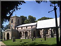
Residents of CB5 8ST have access to three primary schools within practical reach: Fen Ditton Primary School and Marleigh Primary Academy. Both are primary institutions, though specific Ofsted ratings are not provided in the data. The presence of multiple primary schools suggests a focus on early education, which is essential for families with young children. The duplication of Fen Ditton Primary School in the data may indicate either a local emphasis on primary education or a data entry oversight. Regardless, the availability of two primary schools within the area provides options for parents seeking proximity to educational facilities. However, the absence of secondary schools in the data means that families may need to look further afield for secondary education. The mix of schools here is limited to primary institutions, which may be a consideration for those planning long-term family needs.
| Rank | School | Type | Entry gender | Ages |
|---|
Explore more schools in this area
Go to Schools tabDemographics
The community in CB5 8ST is predominantly composed of adults aged 30–64, with a median age of 47. This suggests a mature, established population, likely with long-term ties to the area. Home ownership is high, at 63%, indicating a stable housing market where most residents live in their own homes rather than renting. The accommodation type is primarily houses, which aligns with the area’s rural and semi-rural character. The predominant ethnic group is White, reflecting a homogenous demographic profile. With a population of 1,689 spread over 21.2 hectares, the area maintains a low density, contributing to a sense of privacy and space. While specific deprivation data is not provided, the high home ownership rate and moderate population density suggest a community with relatively stable economic conditions. This profile may appeal to those seeking a settled lifestyle with minimal urban pressures.
Household Size
Accommodation Type
Tenure
Ethnic Group
Religion
Household Composition
Age
Household Deprivation
NS-SEC
Explore more demographic insights in this area
Go to Demographics tabPlanning
Planning Constraints
- Flood RiskPremium
- Ramsar Wetland SitesPremium
- Area of Outstanding Natural BeautyPremium
- Protected Nature ReservePremium
- Protected WoodlandPremium