Area Overview for CB5 8SH
Photos of CB5 8SH


Area Information
CB5 8SH is a compact residential postcode in Cambridge, England, covering 9,436 square metres and home to 1,730 residents. Its small size and clustered layout suggest a tight-knit community, with a median age of 47 and a population skewed toward adults aged 30–64. The area’s history is rooted in 20th-century housing developments, such as the Fen Ditton Fields estate, which expanded significantly between 1918 and 1955. Today, the area is defined by suburban housing laid out around ring-roads, with major thoroughfares like Newmarket Road and Wadloes Road serving as key axes. Despite its modest size, CB5 8SH is well-connected, with nearby rail stations and proximity to Cambridge Airport. Daily life here balances suburban tranquillity with access to urban amenities, making it appealing to families and professionals seeking a manageable commute. The presence of schools, retail outlets, and historical transport infrastructure underscores its role as a functional, if unassuming, part of Cambridge’s broader landscape.
- Area Type
- Postcode
- Area Size
- 9436 m²
- Population
- 1730
- Population Density
- 1107 people/km²
CB5 8SH is characterised by a housing stock dominated by individual homes, with 51% of properties owner-occupied. This suggests a market skewed toward long-term residents rather than transient renters, though the exact proportion of rental properties is unspecified. The predominance of houses over flats or apartments may appeal to families seeking space, aligning with the area’s median age and adult population. Given the postcode’s small size, the property market is likely limited to a few hundred homes, with limited scope for new developments. Buyers should consider that the area’s compact nature means competition for available properties could be fierce, especially for homes near schools or transport links. The historical development of the Fen Ditton Fields estate also implies a mix of older and newer housing stock, which may vary in condition and value. Prospective buyers should prioritise proximity to nearby rail stations and schools, as these are key assets in a small, tightly defined area.
House Prices in CB5 8SH
No properties found in this postcode.
Energy Efficiency in CB5 8SH
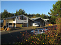
Residents of CB5 8SH have access to a range of local amenities within practical reach. Retail options include Spar, Sainsburys Coldhams, and Co-op Cambridge, providing essential shopping and grocery needs. The area’s proximity to Cambridge Airport and nearby rail stations enhances its connectivity, making it easy to travel further afield. While the data does not specify parks or leisure facilities, the historical presence of Fen Ditton Meadows suggests green spaces may be nearby. The suburban layout and ring-road design likely include local parks or open areas, though specifics are not detailed. The presence of multiple schools and retail outlets indicates a focus on convenience, supporting daily life for families and commuters. The area’s small size means amenities are concentrated, reducing travel time but requiring careful planning for those needing specialist services beyond the immediate vicinity.
Amenities
Schools
Residents of CB5 8SH have access to a range of educational institutions, including The Fields Nursery School, which provides early years education, and two primary schools: Priory Infant School and Priory Junior School. Abbey Meadows Primary School adds further capacity for younger children, while The Galfrid School, an academy with a ‘good’ Ofsted rating, offers secondary education. The mix of nursery, primary, and academy schools caters to families with children of all ages, reducing the need to travel beyond the area for schooling. The Galfrid School’s ‘good’ rating suggests a reliable standard of education, though specific data on performance metrics is not provided. For parents, the availability of multiple schools within walking distance or a short drive is a significant advantage, supporting a family-oriented lifestyle. The presence of both state and academy schools also reflects the area’s integration into Cambridge’s broader educational network.
| Rank | School | Type | Entry gender | Ages |
|---|
Explore more schools in this area
Go to Schools tabDemographics
The population of CB5 8SH is 1,730, with a median age of 47 and the majority (30–64 years) being adults. Home ownership stands at 51%, reflecting a mix of owner-occupied and rental properties. The area is predominantly White, with no specific data on other ethnic groups provided. The accommodation type is primarily houses, which aligns with the suburban layout and suggests a focus on family homes. The population density of 1,107 people per square kilometre indicates a moderately compact settlement, though the small area size means residents are likely to know their neighbours. The age profile suggests a stable, mature community with fewer young children, which may influence local amenities and services. The lack of detailed diversity data means broader demographic trends beyond ethnicity remain unexplored, but the existing figures highlight a settled, middle-aged population with a strong emphasis on home ownership.
Household Size
Accommodation Type
Tenure
Ethnic Group
Religion
Household Composition
Age
Household Deprivation
NS-SEC
Explore more demographic insights in this area
Go to Demographics tabPlanning
Planning Constraints
- Flood RiskPremium
- Ramsar Wetland SitesPremium
- Area of Outstanding Natural BeautyPremium
- Protected Nature ReservePremium
- Protected WoodlandPremium