Area Overview for CB5 8BW
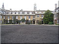
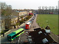
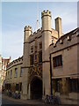
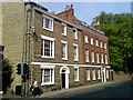
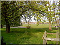
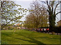
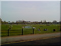
Photos of CB5 8BW


Area Information
Living in CB5 8BW places you at the heart of Cambridge’s historic and modern fabric. This small residential cluster, spanning 1983 m², is part of Market Ward, a central electoral area adjacent to the city’s historic marketplace. With a population of 2612, the area is densely populated, reflecting its compact size and proximity to Cambridge’s core. The postcode sits near the coordinates 52.21007897984696, 0.1174754878405201, placing it within walking distance of the city’s cultural and commercial hubs. Daily life here is shaped by Cambridge’s academic and professional energy, with easy access to rail links, retail, and educational institutions. The area’s compact nature means residents are close to amenities, though its small footprint also means housing options are limited. The blend of historic architecture and modern infrastructure, including nearby St Mary the Great church, adds to its distinct character. For those seeking a central location with a mix of convenience and tradition, CB5 8BW offers a unique position in Cambridge’s evolving landscape.
- Area Type
- Postcode
- Area Size
- 1983 m²
- Population
- 2612
- Population Density
- 4933 people/km²
The property market in CB5 8BW is defined by its limited size and high density, with flats making up the majority of accommodation. With only 26% of residents owning their homes, the area functions more as a rental market than an owner-occupied one. This suggests that housing here is often short-term or transitional, catering to students, professionals, or those working in Cambridge’s academic and corporate sectors. The small area size means the housing stock is constrained, with little scope for expansion or new developments. For buyers, this presents challenges: the limited availability of properties, combined with the area’s proximity to Cambridge’s core, may drive up competition. However, the compact nature of CB5 8BW also means that properties are likely to be in close proximity to amenities, which could be a draw for those prioritising convenience over space.
House Prices in CB5 8BW
Showing 10 properties
| Address | Type | Beds | Baths | Last Sale Price | Last Sale Date | |
|---|---|---|---|---|---|---|
| 48 Jesus Lane, Cambridge, CB5 8BW | undefined | - | - | - | - | |
| 48 Jesus Lane, Cambridge, CB5 8BW | Semi-detached | - | - | - | - | |
| Flat 2, 46 Jesus Lane, Cambridge, CB5 8BW | Flat | - | - | - | - | |
| Flat 1, 46 Jesus Lane, Cambridge, CB5 8BW | Flat | - | - | - | - | |
| Flat 3, 46 Jesus Lane, Cambridge, CB5 8BW | Flat | - | - | - | - | |
| Flat 4, 46 Jesus Lane, Cambridge, CB5 8BW | Flat | - | - | - | - | |
| 36 Jesus Lane, Cambridge, CB5 8BW | Terraced | - | - | - | - | |
| 35 Jesus Lane, Cambridge, CB5 8BW | Terraced | - | - | - | - | |
| 37 Jesus Lane, Cambridge, CB5 8BW | Terraced | - | - | - | - | |
| 47 Jesus Lane, Cambridge, CB5 8BW | Semi-detached | - | - | - | - |
Energy Efficiency in CB5 8BW
Residents of CB5 8BW have access to a range of retail and transport amenities within easy reach. The area is near five retail outlets, including Sainsburys Sidney, M&S Cambridge, and Tesco Cambridge, offering everyday shopping needs. Rail stations such as Cambridge North, Shelford, and Waterbeach provide direct links to Cambridge’s city centre and surrounding areas, enhancing convenience for commuters and visitors. While specific details about parks or leisure facilities are not provided, the proximity to Cambridge’s historic marketplace and cultural institutions suggests opportunities for social and recreational activities. The compact nature of the area means amenities are closely clustered, supporting a lifestyle that prioritises accessibility and efficiency.
Amenities
Schools
The nearest school to CB5 8BW is Park Street CofE Primary School, which serves the local community with a good Ofsted rating. This school is a key resource for families in the area, offering primary education within walking distance of many homes. The absence of secondary schools in the immediate vicinity means families may need to consider commuting to nearby districts for secondary education, though Cambridge’s well-connected transport network could ease this. The presence of a rated primary school is a positive factor for parents, though the lack of data on secondary education options suggests further research may be needed for families with older children.
| Rank | School | Type | Entry gender | Ages |
|---|
Explore more schools in this area
Go to Schools tabDemographics
The community in CB5 8BW is predominantly young, with a median age of 22 and the most common age range being 15–29 years. This reflects a population skewed toward students and early-career professionals, many of whom may be linked to Cambridge’s universities or nearby employment sectors. Home ownership is relatively low at 26%, suggesting that a significant portion of the population rents, likely in the flats that dominate the area’s accommodation type. The predominant ethnic group is White, though no specific data on diversity beyond this is provided. The high population density—1316973 people per km²—means the area is intensely populated, which can influence the pace of life and availability of shared spaces. For those considering living here, the demographic profile indicates a dynamic, youthful environment, though it may lack the generational diversity seen in larger, more mixed communities.
Household Size
Accommodation Type
Tenure
Ethnic Group
Religion
Household Composition
Age
Household Deprivation
NS-SEC
Explore more demographic insights in this area
Go to Demographics tabPlanning
Planning Constraints
- Flood RiskPremium
- Ramsar Wetland SitesPremium
- Area of Outstanding Natural BeautyPremium
- Protected Nature ReservePremium
- Protected WoodlandPremium