Area Overview for CB4 3ND
Photos of CB4 3ND
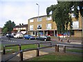

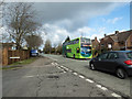
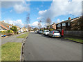


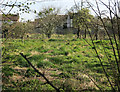
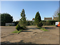
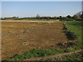
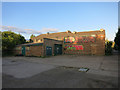
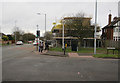
100 photos from this area
Area Information
Key information about the CB4 3ND including its size, population, and administrative classification.
- Area Type
- Postcode
- Area Size
- 7319 m²
- Population
- 1466
- Population Density
- 3209 people/km²
House Prices in CB4 3ND
17
Properties
£296,095
Average Sold Price
£75,000
Lowest Price
£590,000
Highest Price
Showing 17 properties
| Address | Type | Beds | Baths | Last Sale Price | Last Sale Date | |
|---|---|---|---|---|---|---|
| 97 Tavistock Road, Cambridge, CB4 3ND | Maisonette | 2 | 2 | £325,000 | Dec 2024 | |
| 87 Tavistock Road, Cambridge, CB4 3ND | Detached | 3 | 1 | £590,000 | Dec 2024 | |
| 93 Tavistock Road, Cambridge, CB4 3ND | Detached | 3 | 1 | £430,000 | May 2019 | |
| 54 Tavistock Road, Cambridge, CB4 3ND | Bungalow | 3 | 1 | £395,000 | Dec 2018 | |
| 56 Tavistock Road, Cambridge, CB4 3ND | Bungalow | 2 | 1 | £400,000 | Jul 2015 | |
| 97A Tavistock Road, Cambridge, CB4 3ND | Maisonette | - | - | £199,950 | Aug 2011 | |
| 52 Tavistock Road, Cambridge, CB4 3ND | Semi-detached | 3 | 1 | £216,000 | Aug 2005 | |
| 50 Tavistock Road, Cambridge, CB4 3ND | Detached | 3 | 1 | £165,000 | Jun 2002 | |
| 91 Tavistock Road, Cambridge, CB4 3ND | Detached | - | - | £165,000 | Apr 2001 | |
| 101 Tavistock Road, Cambridge, CB4 3ND | house | - | - | £75,000 | Sep 1997 |
Page 1 of 2
Energy Efficiency in CB4 3ND
Amenities
Schools
| Rank | School | Type | Entry gender | Ages |
|---|
Explore more schools in this area
Go to Schools tabDemographics
Household Size
Two person
most common
Accommodation Type
Houses
most common
Tenure
68
majority
Ethnic Group
White
most common
Religion
N/A
most common
Household Composition
N/A
most common
Age
47
median
Adults (30-64 years)
most common
Household Deprivation
N/A
with no deprivation
NS-SEC
51
in Lower managerial occupations
Explore more demographic insights in this area
Go to Demographics tabPlanning
Planning Constraints
- Flood RiskPremium
- Ramsar Wetland SitesPremium
- Area of Outstanding Natural BeautyPremium
- Protected Nature ReservePremium
- Protected WoodlandPremium