Area Overview for CB4 3HG
Photos of CB4 3HG
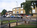
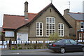
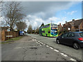
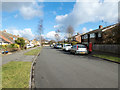
100 photos from this area
Area Information
Key information about the CB4 3HG including its size, population, and administrative classification.
- Area Type
- Postcode
- Area Size
- 1.5 hectares
- Population
- 2104
- Population Density
- 7961 people/km²
House Prices in CB4 3HG
53
Properties
£266,458
Average Sold Price
£23,000
Lowest Price
£506,000
Highest Price
Showing 53 properties
| Address | Type | Beds | Baths | Last Sale Price | Last Sale Date | |
|---|---|---|---|---|---|---|
| 28 Akeman Street, Cambridge, CB4 3HG | Semi-detached | 3 | 2 | £490,000 | Jan 2025 | |
| 34 Akeman Street, Cambridge, CB4 3HG | Semi-detached | 3 | 1 | £506,000 | Aug 2023 | |
| 46 Akeman Street, Cambridge, CB4 3HG | house | 3 | 2 | £426,000 | Oct 2021 | |
| 22 Akeman Street, Cambridge, CB4 3HG | Semi-detached | 3 | 2 | £370,000 | Apr 2016 | |
| 32 Akeman Street, Cambridge, CB4 3HG | Semi-detached | 3 | - | £330,000 | Jan 2015 | |
| 50 Akeman Street, Cambridge, CB4 3HG | Semi-detached | 3 | - | £280,000 | Mar 2013 | |
| 60 Akeman Street, Cambridge, CB4 3HG | Semi-detached | - | - | £250,000 | Mar 2008 | |
| 52 Akeman Street, Cambridge, CB4 3HG | Semi-detached | 4 | 1 | £263,500 | Mar 2008 | |
| 72 Akeman Street, Cambridge, CB4 3HG | Semi-detached | - | - | £23,000 | Feb 2001 | |
| 54 Akeman Street, Cambridge, CB4 3HG | Semi-detached | - | - | £107,000 | Jan 2001 |
Page 1 of 6
Energy Efficiency in CB4 3HG
Amenities
Schools
| Rank | School | Type | Entry gender | Ages |
|---|
Explore more schools in this area
Go to Schools tabDemographics
Household Size
One person
most common
Accommodation Type
Houses
most common
Tenure
50
majority
Ethnic Group
White
most common
Religion
N/A
most common
Household Composition
N/A
most common
Age
47
median
Adults (30-64 years)
most common
Household Deprivation
N/A
with no deprivation
NS-SEC
32
in Lower managerial occupations
Explore more demographic insights in this area
Go to Demographics tabPlanning
Planning Constraints
- Flood RiskPremium
- Ramsar Wetland SitesPremium
- Area of Outstanding Natural BeautyPremium
- Protected Nature ReservePremium
- Protected WoodlandPremium