Area Overview for CB4 0HH
Photos of CB4 0HH


Area Information
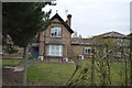
Living in CB4 0HH means residing within East Chesterton Ward, a residential suburb of Cambridge characterised by a population of 1,654 people. This postcode covers a small residential cluster that forms part of the historic Chesterton area, a neighbourhood that grew in the 20th century. Originally a High Street near the River Cam to the north and east of the city centre, this district now exists as a distinct suburban environment. The area has deep historical roots, having seen the construction of a workhouse on Union Road between 1836 and 1838 before transforming into a modern housing cluster. Residents enjoy a specific postcode area that balances suburban quiet with proximity to the city. The density here is significant at 1,285 people per square kilometre, creating a populated yet defined neighbourhood feel. Homebuyers looking at east Chesterton find themselves in a unitary authority setting within Cambridgeshire, England. The ward remains centred around coordinates near 0.156706 longitude, anchoring it geographically within the broader strategic region. Your daily life here is shaped by this specific residential footprint, which has evolved significantly since the late 19th century when amalgamation proposals were discussed and eventually dropped in 1897. Today, the area functions as a stable residential zone rather than an industrial or commercial hub, offering a journey from marshy origins to a contemporary suburban existence.
- Area Type
- Postcode
- Area Size
- Not available
- Population
- 1654
- Population Density
- 1285 people/km²
The property market in CB4 0HH is defined by housing stock that consists primarily of houses, with a home ownership rate of 33 per cent. This specific breakdown indicates that while private ownership exists, a substantial majority of residents rent their properties. Buyers examining homes in this postcode area should expect a market where rental volumes may be high relative to sales volumes. The accommodation type is exclusively houses, meaning flats or apartments are not a feature of the local stock. This structural characteristic shapes the utility and price points of available properties significantly. You will find that the housing stock is built to support families or individuals seeking the space typically associated with houses rather than the compact footprint of flats. The 33 per cent ownership statistic signifies that two-thirds of the population are tenants, suggesting a robust letting market driven by housing associations or private landlords operating in Cambridgeshire. Potential purchasers entering this space face a competition against the rental sector, as the low ownership percentage implies less pressure on the owner-occupied ladder compared to areas with higher tenure rates. The area classification as a small residential cluster further limits the sheer volume of properties available for purchase at any given moment. Your search for homes in CB4 0HH will therefore require your attention to be focused carefully on specific listings within CB4 0HH, given the restricted supply of housing units.
House Prices in CB4 0HH
No properties found in this postcode.
Energy Efficiency in CB4 0HH
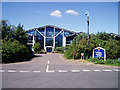
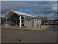
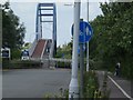
The lifestyle available in CB4 0HH is anchored by a range of amenities located within practical reach of your doorstep. For retail needs, five local shops operate nearby, including Co-op Cambridge, East of England Co-operative Co, and Tesco Cambridge. These venues provide essential groceries and daily necessities without requiring a trip into central Cambridge. On the transport front, the three nearby railway stations facilitate easy movement across the country. Cambridge North Railway Station allows for direct connections to London, while Waterbeach and Shelford stations serve local routes. Two airports, both identified as Cambridge Airport, offer access to global destinations. The area is steeped in history, featuring a former workhouse built between 1836 and 1838, which was later redeveloped into a hospital and health centre. Today, the site stands as a testament to the ward's evolution. An East Chesterton Ward Conservative Association hall in Union Lane serves as a community gathering point for local residents. The historic High Street near the River Cam remains a landmark, preserving the area's connection to its origins as a marshy district that became home to New Town. Your daily rhythm in CB4 0HH involves shifting between the quiet of this suburban ward and the conveniences of nearby retail and transport hubs.
Amenities
Schools
Families residing in CB4 0HH have access to two specific schools within the immediate locality that serve the educational needs of children in the area. Shirley Community Primary School operates as a primary institution with an Ofsted rating of good, providing a regulated standard of education for younger children. Nearby, St Andrew's CofE Community VA Junior School also serves as a primary institution, catering to a similar age group. This mix of state-backed primary education options is typical for a suburban environment like CB4 0HH. The presence of a Church of England Voluntary Aided variant alongside a community school suggests a diversity in educational philosophy while maintaining a focus on primary-level instruction. Because both listed schools are primary institutions, the immediate catchment area focuses heavily on educating children from early years up to the junior phase. There are no secondary schools listed in the immediate vicinity of this postcode, which means older students may require travel to reach secondary education facilities elsewhere. You must consider the distance to high schools when evaluating the suitability of a home in CB4 0HH for a growing family. The reliability indicated by the 'good' rating at Shirley Community Primary School offers reassurance regarding the quality of education available to local pupils.
| Rank | School | Type | Entry gender | Ages |
|---|
Explore more schools in this area
Go to Schools tabDemographics
The community profile of CB4 0HH reflects a mature demographic structure with a median age of 47 years. Most residents fall into the adult age range of 30 to 64 years, indicating a neighbourhood where the working-age population dominates the landscape. Home ownership stands at 33 per cent, meaning exactly one in three households owns their property outright or with a mortgage. This relatively modest ownership rate suggests a significant proportion of the population consists of tenants rather than owners. The available data identifies houses as the predominant accommodation type throughout this postcode. Cultural diversity is largely represented by a White majority as the predominant ethnic group. These figures describe a resident base that is neither exceptionally young nor elderly, with residents fitting squarely into the mid-life demographic bracket. Such a population often characterises established suburbs where families settle for the long term. The 33 per cent ownership figure is a concrete fact that helps potential buyers understand the transmission dynamics of this market. If you are considering homes in CB4 0HH, you are entering a market where rental occupancy remains a notable feature alongside private ownership. The concentration of adults between 30 and 64 years suggests local demand will focus on stability and family-oriented living rather than youth-centric amenities.
Household Size
Accommodation Type
Tenure
Ethnic Group
Religion
Household Composition
Age
Household Deprivation
NS-SEC
Explore more demographic insights in this area
Go to Demographics tabPlanning
Planning Constraints
- Flood RiskPremium
- Ramsar Wetland SitesPremium
- Area of Outstanding Natural BeautyPremium
- Protected Nature ReservePremium
- Protected WoodlandPremium