Area Overview for CB4 0HB
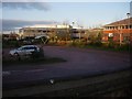
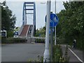
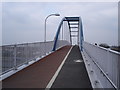
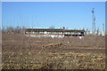
Photos of CB4 0HB


Area Information
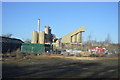
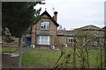
CB4 0HB is a small residential cluster nestled in the northeast of Cambridge, part of the historic Chesterton area. With a population of 1,654 and a high density of 1,285 people per square kilometre, this postcode reflects a compact, suburban neighbourhood that evolved from a 19th-century marshy landscape into a post-war expansion of Cambridge. Its core is defined by a High Street near the River Cam, a remnant of its early development. The area’s character is shaped by its proximity to the city’s historic boundaries and its integration into modern Cambridge’s infrastructure. Residents benefit from proximity to rail networks, including Cambridge North and Shelford stations, and a range of retail outlets, from Co-op Cambridge to Tesco. While the area is residential, it sits at the edge of Cambridge’s urban sprawl, offering a blend of historical context and contemporary amenities. For buyers, CB4 0HB represents a compact, established community with a focus on local connectivity and a manageable footprint.
- Area Type
- Postcode
- Area Size
- Not available
- Population
- 1654
- Population Density
- 1285 people/km²
The property market in CB4 0HB is defined by a 33% home ownership rate, suggesting that the majority of properties are rented rather than owner-occupied. This aligns with the area’s role as a suburban extension of Cambridge, where rental demand may be higher due to proximity to the city’s employment hubs. The predominant accommodation type is houses, which is typical for suburban areas but contrasts with the higher density of nearby urban zones. Given the small size of the postcode, the housing stock is likely limited, with buyers needing to consider nearby areas for a broader selection. The low home ownership rate may also indicate a transient population, which could affect property values and market stability. For those seeking owner-occupied homes, CB4 0HB may require a broader search beyond its immediate boundaries, though its proximity to Cambridge’s rail network and amenities could make it an attractive option for commuters.
House Prices in CB4 0HB
No properties found in this postcode.
Energy Efficiency in CB4 0HB
Living in CB4 0HB offers a mix of suburban convenience and proximity to Cambridge’s amenities. The area’s retail options include major chains like Co-op Cambridge and Tesco, ensuring easy access to groceries and everyday essentials. Three railway stations—Cambridge North, Waterbeach, and Shelford—provide direct links to the city and surrounding areas, making commuting efficient. The presence of two airports, both named Cambridge Airport, suggests strong regional transport links, though their exact roles are unclear. The area’s historical character, including the High Street near the River Cam, adds a sense of local identity. While the postcode itself is small, its connectivity to Cambridge’s broader infrastructure ensures residents can access cultural, professional, and recreational opportunities in the city. The mix of retail, transport, and historical elements creates a lifestyle that balances local convenience with urban accessibility.
Amenities
Schools
Residents of CB4 0HB have access to two primary schools: Shirley Community Primary School, which holds a ‘good’ Ofsted rating, and St Andrew’s CofE Community VA Junior School. Both institutions cater to younger children, offering a mix of state and church-affiliated education options. The presence of two primary schools within reach suggests that families with young children can find nearby schooling, though the absence of secondary schools in the immediate area may require commuting to Cambridge or surrounding towns. The ‘good’ rating at Shirley Community Primary indicates a solid educational standard, while St Andrew’s CofE provides a faith-based alternative. Together, these schools offer parents a choice between secular and religious education, reflecting the area’s diverse community needs. However, the lack of secondary-level schooling within the postcode means that long-term educational planning for older children would need to consider proximity to larger towns.
| Rank | School | Type | Entry gender | Ages |
|---|---|---|---|---|
| 1 | Shirley Community Primary School | primary | N/A | N/A |
| 2 | St Andrew's CofE Community VA Junior School | primary | N/A | N/A |
Explore more schools in this area
Go to Schools tabDemographics
The population of CB4 0HB has a median age of 47, with the majority of residents falling within the 30-64 age range. This suggests a mature, stable community with a significant proportion of working-age adults. Home ownership is relatively low at 33%, indicating that a large share of properties are rented, which may reflect the area’s role as a secondary housing market within Cambridge. The predominant accommodation type is houses, which aligns with the suburban character of the area. The predominant ethnic group is White, with no specific data on diversity or deprivation levels provided. The age profile suggests a community that may include families with school-age children, though the proportion of younger residents is not explicitly stated. The relatively low home ownership rate could imply a transient population or a focus on rental properties, which may influence the local housing market dynamics.
Household Size
Accommodation Type
Tenure
Ethnic Group
Religion
Household Composition
Age
Household Deprivation
NS-SEC
Explore more demographic insights in this area
Go to Demographics tabPlanning
Planning Constraints
- Flood RiskPremium
- Ramsar Wetland SitesPremium
- Area of Outstanding Natural BeautyPremium
- Protected Nature ReservePremium
- Protected WoodlandPremium
- Crime RiskPremium