Area Overview for CB4 0DT
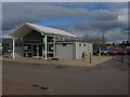
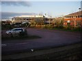
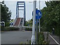
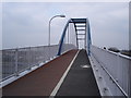
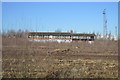
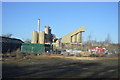
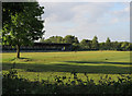
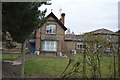
Photos of CB4 0DT


Area Information
Living in CB4 0DT means inhabiting a small, densely populated residential cluster within Cambridge’s eastern suburbs. The area covers just 2.2 hectares, yet it houses 1,654 people, translating to a high population density of 1,285 people per square kilometre. This compact postcode is part of the historic Chesterton neighbourhood, which evolved from a 19th-century marshy expanse into a suburban district centred around the River Cam. Its urban fabric reflects post-WWII expansion, with a surviving High Street core and a mix of modern housing. Daily life here is shaped by proximity to Cambridge’s amenities, including multiple rail stations and retail hubs. The area’s compact size means residents are within easy reach of the city’s cultural and economic heart, while retaining a distinct local identity rooted in its historical development. For those seeking a blend of suburban tranquillity and urban connectivity, CB4 0DT offers a microcosm of Cambridge’s character.
- Area Type
- Postcode
- Area Size
- 2.2 hectares
- Population
- 1654
- Population Density
- 1285 people/km²
The property market in CB4 0DT is defined by its low home ownership rate of 33%, indicating that the majority of properties are rented rather than owner-occupied. This suggests a rental market that may cater to professionals or families requiring flexibility. The accommodation type is predominantly houses, which are typically larger than flats and may appeal to those seeking more space. However, the small area size of 2.2 hectares and high population density mean the housing stock is limited, potentially driving competition for available properties. Buyers should consider the surrounding areas for more extensive options, as the immediate vicinity of CB4 0DT offers minimal expansion. The focus on houses also implies that the area may not be ideal for those prioritising affordability or smaller living spaces. For those seeking a suburban home with a connection to Cambridge’s amenities, CB4 0DT’s properties reflect a niche market with specific appeal.
House Prices in CB4 0DT
Showing 1 properties
| Address | Type | Beds | Baths | Last Sale Price | Last Sale Date | |
|---|---|---|---|---|---|---|
| Cambridge City Council, The Cowley Road Depot, Cowley Road, Cambridge, CB4 0DT | office_workshop | - | - | - | - |
Energy Efficiency in CB4 0DT
The lifestyle in CB4 0DT is shaped by its proximity to retail, transport, and historical sites. Nearby retail options include Co-op Cambridge, East of England Co-operative Co, and Tesco Cambridge, providing essential shopping and dining choices. The area’s rail stations—Cambridge North, Waterbeach, and Shelford—offer easy access to Cambridge’s cultural and economic hubs, while the two listed airports (Cambridge Airport) suggest potential for regional travel. Historically, the area’s High Street near the River Cam retains a suburban character, with redeveloped spaces like the former Chesterton Union workhouse now housing modern residences and a health centre. This blend of practical amenities and historic landmarks contributes to a lifestyle that balances convenience with a sense of local heritage. Residents benefit from a compact, well-connected environment that supports both daily needs and leisure activities.
Amenities
Schools
Residents of CB4 0DT have access to two primary schools within practical reach: Shirley Community Primary School, which holds an Ofsted rating of ‘good’, and St Andrew’s CofE Community VA Junior School. Both institutions serve the local community, offering a mix of state and church-affiliated education. The presence of two primary schools provides families with options, though no secondary schools are listed in the data. The ‘good’ Ofsted rating at Shirley Community Primary indicates a school that meets quality standards, though it does not guarantee excellence. For families prioritising educational diversity, the availability of two schools may be a benefit, but the absence of secondary education options within the area could necessitate commuting to nearby districts. The proximity of these schools to residential properties underscores their importance in shaping the daily lives of local children and their families.
| Rank | School | Type | Entry gender | Ages |
|---|
Explore more schools in this area
Go to Schools tabDemographics
The community in CB4 0DT is predominantly middle-aged, with a median age of 47 and the most common age range being adults aged 30–64. This suggests a stable population of working-age individuals and families. Home ownership here is relatively low at 33%, indicating a significant proportion of residents rent their homes. The area is characterised by houses as the primary accommodation type, reflecting a focus on family homes rather than flats or apartments. The predominant ethnic group is White, though no specific diversity statistics are provided. The population density of 1,285 people per square kilometre implies a tightly packed residential environment, which may influence the availability of private outdoor space. For those considering the area, the demographic profile suggests a mature, established community with limited turnover, which can be both a stabilising factor and a challenge for new residents seeking a dynamic social environment.
Household Size
Accommodation Type
Tenure
Ethnic Group
Religion
Household Composition
Age
Household Deprivation
NS-SEC
Explore more demographic insights in this area
Go to Demographics tabPlanning
Planning Constraints
- Flood RiskPremium
- Ramsar Wetland SitesPremium
- Area of Outstanding Natural BeautyPremium
- Protected Nature ReservePremium
- Protected WoodlandPremium