Area Overview for CB3 9NQ
Photos of CB3 9NQ
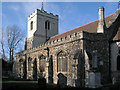
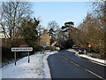
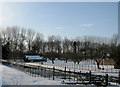
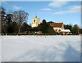
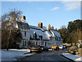
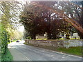
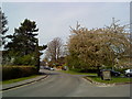
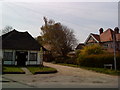
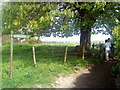
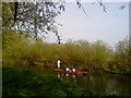
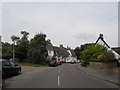
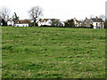
100 photos from this area
Area Information
Key information about the CB3 9NQ including its size, population, and administrative classification.
- Area Type
- Postcode
- Area Size
- 18.2 hectares
- Population
- 1040
- Population Density
- 136 people/km²
House Prices in CB3 9NQ
31
Properties
£496,455
Average Sold Price
£139,000
Lowest Price
£932,000
Highest Price
Showing 31 properties
| Address | Type | Beds | Baths | Last Sale Price | Last Sale Date | |
|---|---|---|---|---|---|---|
| 8 Broadway, Grantchester, CB3 9NQ | Detached | 4 | 1 | £740,000 | Mar 2023 | |
| 65 Broadway, Grantchester, CB3 9NQ | house | - | - | £570,000 | Oct 2022 | |
| 81 Broadway, Grantchester, CB3 9NQ | house | - | - | £483,000 | Jun 2021 | |
| 23 Broadway, Grantchester, CB3 9NQ | house | - | - | £846,000 | Aug 2020 | |
| 35 Broadway, Grantchester, CB3 9NQ | Detached | - | - | £932,000 | Aug 2017 | |
| 67 Broadway, Grantchester, CB3 9NQ | house | - | - | £295,000 | Jul 2012 | |
| 75 Broadway, Grantchester, CB3 9NQ | Terraced | - | - | £250,000 | Feb 2011 | |
| 59 Broadway, Grantchester, CB3 9NQ | house | 2 | 1 | £301,000 | Aug 2010 | |
| 39 Broadway, Grantchester, CB3 9NQ | Detached | - | - | £600,000 | Sep 2004 | |
| 45 Broadway, Grantchester, CB3 9NQ | house | - | - | £305,000 | Aug 2000 |
Page 1 of 4
Energy Efficiency in CB3 9NQ
Amenities
Schools
| Rank | School | Type | Entry gender | Ages |
|---|
Explore more schools in this area
Go to Schools tabDemographics
Household Size
Two person
most common
Accommodation Type
Houses
most common
Tenure
66
majority
Ethnic Group
White
most common
Religion
N/A
most common
Household Composition
N/A
most common
Age
47
median
Adults (30-64 years)
most common
Household Deprivation
N/A
with no deprivation
NS-SEC
51
in Lower managerial occupations
Explore more demographic insights in this area
Go to Demographics tabPlanning
Planning Constraints
- Flood RiskPremium
- Ramsar Wetland SitesPremium
- Area of Outstanding Natural BeautyPremium
- Protected Nature ReservePremium
- Protected WoodlandPremium