Area Overview for CB3 0DH
Photos of CB3 0DH
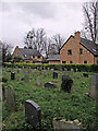
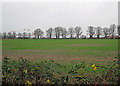
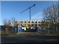
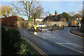
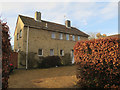
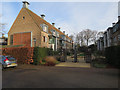
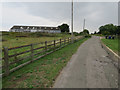
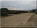
100 photos from this area
Area Information
Key information about the CB3 0DH including its size, population, and administrative classification.
- Area Type
- Postcode
- Area Size
- 6.6 hectares
- Population
- 1031
- Population Density
- 678 people/km²
House Prices in CB3 0DH
24
Properties
£846,978
Average Sold Price
£225,000
Lowest Price
£1,339,000
Highest Price
Showing 24 properties
| Address | Type | Beds | Baths | Last Sale Price | Last Sale Date | |
|---|---|---|---|---|---|---|
| 143 Huntingdon Road, Cambridge, CB3 0DH | Detached | 4 | 2 | £1,262,500 | Mar 2025 | |
| 175 Huntingdon Road, Cambridge, CB3 0DH | house | - | - | £1,025,000 | Jan 2021 | |
| 147 Huntingdon Road, Cambridge, CB3 0DH | house | - | - | £1,339,000 | Feb 2017 | |
| 173 Huntingdon Road, Cambridge, CB3 0DH | house | - | - | £1,220,000 | Feb 2016 | |
| 159 Huntingdon Road, Cambridge, CB3 0DH | Detached | 4 | 2 | £950,000 | Jan 2016 | |
| 153 Huntingdon Road, Cambridge, CB3 0DH | Detached | 4 | 3 | £1,199,950 | Dec 2014 | |
| 157 Huntingdon Road, Cambridge, CB3 0DH | Detached | - | - | £850,000 | Jul 2013 | |
| 179 Huntingdon Road, Cambridge, CB3 0DH | Detached | - | - | £900,000 | Jan 2007 | |
| 177 Huntingdon Road, Cambridge, CB3 0DH | house | - | - | £636,235 | Dec 2006 | |
| 171 Huntingdon Road, Cambridge, CB3 0DH | Detached | - | - | £535,000 | Dec 2005 |
Page 1 of 3
Energy Efficiency in CB3 0DH
Amenities
Schools
| Rank | School | Type | Entry gender | Ages |
|---|
Explore more schools in this area
Go to Schools tabDemographics
Household Size
One person
most common
Accommodation Type
Flats
most common
Tenure
33
majority
Ethnic Group
White
most common
Religion
N/A
most common
Household Composition
N/A
most common
Age
47
median
Adults (30-64 years)
most common
Household Deprivation
N/A
with no deprivation
NS-SEC
63
in Lower managerial occupations
Explore more demographic insights in this area
Go to Demographics tabPlanning
Planning Constraints
- Flood RiskPremium
- Ramsar Wetland SitesPremium
- Area of Outstanding Natural BeautyPremium
- Protected Nature ReservePremium
- Protected WoodlandPremium