Area Overview for CB25 9FD
Photos of CB25 9FD
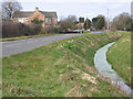

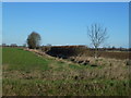
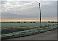
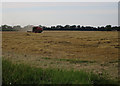
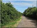
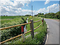

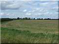
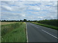
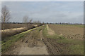
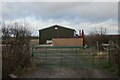
17 photos from this area
Area Information
Key information about the CB25 9FD including its size, population, and administrative classification.
- Area Type
- Postcode
- Area Size
- 2.2 km²
- Population
- 1243
- Population Density
- 115 people/km²
House Prices in CB25 9FD
100
Properties
£243,600
Average Sold Price
£78,500
Lowest Price
£467,000
Highest Price
Showing 100 properties
| Address | Type | Beds | Baths | Last Sale Price | Last Sale Date | |
|---|---|---|---|---|---|---|
| 83 Green End, Landbeach, CB25 9FD | Cottage | 2 | 1 | £260,000 | Jul 2023 | |
| 67 Green End, Landbeach, CB25 9FD | Terraced | 2 | 1 | £322,000 | Oct 2022 | |
| 18 Green End, Landbeach, CB25 9FD | Bungalow | 1 | - | £195,000 | Sep 2021 | |
| 59 Green End, Landbeach, CB25 9FD | house | 3 | - | £276,000 | Jun 2021 | |
| 40 Green End, Landbeach, CB25 9FD | Cottage | 3 | 2 | £467,000 | Nov 2015 | |
| 63 Green End, Landbeach, CB25 9FD | Bungalow | - | - | £208,000 | Nov 2013 | |
| 57 Green End, Landbeach, CB25 9FD | Terraced | 3 | 1 | £184,000 | Nov 2013 | |
| 22 Green End, Landbeach, CB25 9FD | house | 3 | 1 | £204,000 | Nov 2012 | |
| 30 Green End, Landbeach, CB25 9FD | Detached | 3 | - | £395,000 | Jun 2012 | |
| 69 Green End, Landbeach, CB25 9FD | house | 3 | - | £191,000 | Dec 2011 |
Page 1 of 10
Energy Efficiency in CB25 9FD
Amenities
Schools
| Rank | School | Type | Entry gender | Ages |
|---|
Explore more schools in this area
Go to Schools tabDemographics
Household Size
Two person
most common
Accommodation Type
Houses
most common
Tenure
64
majority
Ethnic Group
White
most common
Religion
N/A
most common
Household Composition
N/A
most common
Age
47
median
Adults (30-64 years)
most common
Household Deprivation
N/A
with no deprivation
NS-SEC
42
in Lower managerial occupations
Explore more demographic insights in this area
Go to Demographics tabPlanning
Planning Constraints
- Flood RiskPremium
- Ramsar Wetland SitesPremium
- Area of Outstanding Natural BeautyPremium
- Protected Nature ReservePremium
- Protected WoodlandPremium