Area Overview for CB25 9EW
Photos of CB25 9EW
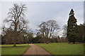
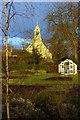
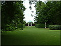
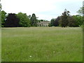
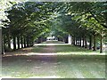
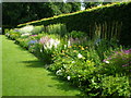
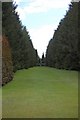
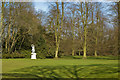
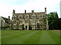

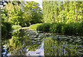
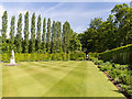
100 photos from this area
Area Information
Key information about the CB25 9EW including its size, population, and administrative classification.
- Area Type
- Postcode
- Area Size
- 2.3 hectares
- Population
- 2606
- Population Density
- 63 people/km²
House Prices in CB25 9EW
19
Properties
£321,045
Average Sold Price
£110,000
Lowest Price
£663,000
Highest Price
Showing 19 properties
| Address | Type | Beds | Baths | Last Sale Price | Last Sale Date | |
|---|---|---|---|---|---|---|
| 36 High Street, Lode, CB25 9EW | Terraced | 2 | 1 | £370,000 | Dec 2025 | |
| Norman House, 41 High Street, Lode, CB25 9EW | Detached | 4 | 2 | £330,000 | May 2024 | |
| Raleighs Holt, 29 High Street, Lode, CB25 9EW | house | - | - | £663,000 | Jul 2022 | |
| 39 High Street, Lode, CB25 9EW | Terraced | 4 | 3 | £385,000 | Apr 2018 | |
| 32 High Street, Lode, CB25 9EW | house | - | - | £400,000 | Oct 2015 | |
| 44 High Street, Lode, CB25 9EW | house | 4 | - | £237,500 | Nov 2011 | |
| 37 High Street, Lode, CB25 9EW | house | - | - | £245,000 | Nov 2009 | |
| 34 High Street, Lode, CB25 9EW | Terraced | - | - | £210,000 | Jul 2009 | |
| 26 High Street, Lode, CB25 9EW | Detached | 5 | 3 | £380,000 | Dec 2005 | |
| 33 High Street, Lode, CB25 9EW | house | - | - | £201,000 | Aug 2005 |
Page 1 of 2
Energy Efficiency in CB25 9EW
Amenities
Schools
| Rank | School | Type | Entry gender | Ages |
|---|
Explore more schools in this area
Go to Schools tabDemographics
Household Size
Two person
most common
Accommodation Type
Houses
most common
Tenure
77
majority
Ethnic Group
White
most common
Religion
N/A
most common
Household Composition
N/A
most common
Age
47
median
Adults (30-64 years)
most common
Household Deprivation
N/A
with no deprivation
NS-SEC
44
in Lower managerial occupations
Explore more demographic insights in this area
Go to Demographics tabPlanning
Planning Constraints
- Flood RiskPremium
- Ramsar Wetland SitesPremium
- Area of Outstanding Natural BeautyPremium
- Protected Nature ReservePremium
- Protected WoodlandPremium