Area Overview for CB25 9DJ
Photos of CB25 9DJ
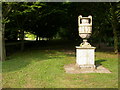
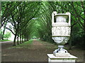
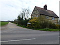
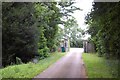
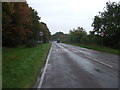
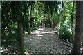
17 photos from this area
Area Information
Key information about the CB25 9DJ including its size, population, and administrative classification.
- Area Type
- Postcode
- Area Size
- 77.3 hectares
- Population
- 1623
- Population Density
- 889 people/km²
House Prices in CB25 9DJ
57
Properties
£323,639
Average Sold Price
£80,000
Lowest Price
£550,000
Highest Price
Showing 57 properties
| Address | Type | Beds | Baths | Last Sale Price | Last Sale Date | |
|---|---|---|---|---|---|---|
| 26A Lode Road, Bottisham, CB25 9DJ | Bungalow | 3 | 1 | £310,000 | Mar 2025 | |
| 11 Lode Road, Bottisham, CB25 9DJ | Chalet | 3 | 2 | £510,000 | Mar 2025 | |
| 1, Bradford Cottages, Lode Road, Bottisham, CB25 9DJ | Detached | 3 | 1 | £497,000 | Nov 2022 | |
| 115 Lode Road, Bottisham, CB25 9DJ | house | 3 | - | £375,000 | Mar 2022 | |
| Thornbury, 52 Lode Road, Bottisham, CB25 9DJ | Bungalow | - | - | £320,000 | May 2021 | |
| 3, Bradford Cottages, Lode Road, Bottisham, CB25 9DJ | Terraced | - | - | £375,000 | Feb 2021 | |
| 46 Lode Road, Bottisham, CB25 9DJ | Bungalow | 2 | 1 | £275,000 | Dec 2019 | |
| Old Orchard House, 55A Lode Road, Bottisham, CB25 9DJ | Detached | 5 | 3 | £430,000 | Jun 2019 | |
| The Old Telephone Exchange, 7 Lode Road, Bottisham, CB25 9DJ | Bungalow | 2 | 1 | £240,000 | Mar 2019 | |
| 16 Lode Road, Bottisham, CB25 9DJ | Detached | 4 | - | £550,000 | Jul 2016 |
Page 1 of 6
Energy Efficiency in CB25 9DJ
Amenities
Schools
| Rank | School | Type | Entry gender | Ages |
|---|
Explore more schools in this area
Go to Schools tabDemographics
Household Size
Family (3-5 people)
most common
Accommodation Type
Houses
most common
Tenure
66
majority
Ethnic Group
White
most common
Religion
N/A
most common
Household Composition
N/A
most common
Age
47
median
Adults (30-64 years)
most common
Household Deprivation
N/A
with no deprivation
NS-SEC
39
in Lower managerial occupations
Explore more demographic insights in this area
Go to Demographics tabPlanning
Planning Constraints
- Flood RiskPremium
- Ramsar Wetland SitesPremium
- Area of Outstanding Natural BeautyPremium
- Protected Nature ReservePremium
- Protected WoodlandPremium