Area Overview for CB25 0WY
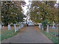
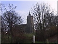
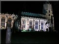
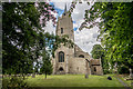
Photos of CB25 0WY
Area Information
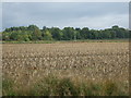
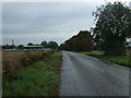
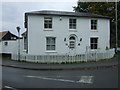
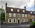
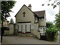
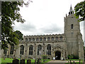
CB25 0WY is a small residential postcode area in Cambridgeshire, nestled in the village of Burwell. With a population of 1,759 and a density of 1,325 people per square kilometre, it is a tightly knit community centred around historic and natural features. Burwell itself lies at the head of Burwell Lode, a man-made waterway that historically linked the village to the River Cam, reflecting its long-standing role in local trade and transport. The area is characterised by its mix of traditional architecture and modern amenities, with homes predominantly occupied by homeowners. The median age of 47 suggests a mature, stable population, with the majority aged between 30 and 64. Daily life here balances rural tranquillity with proximity to essential services, including retail outlets and rail links. The village’s heritage, including the ruins of Burwell Castle and St Mary’s Church, adds a layer of historical depth to its modern appeal. For those seeking a quiet, established community with easy access to nearby towns, CB25 0WY offers a blend of heritage and practicality.
- Area Type
- Postcode
- Area Size
- Not available
- Population
- 1759
- Population Density
- 1325 people/km²
The property market in CB25 0WY is dominated by owner-occupied homes, with 78% of residents living in properties they own. This high rate of homeownership indicates a stable market where long-term residency is common. The accommodation type is primarily houses, which are typically larger and more private than flats or apartments. This suggests a demand for family-friendly housing, though the area’s small size means the housing stock is limited. Buyers should consider the immediate surroundings for additional options, as the postcode covers a small cluster of residences. The predominance of owner-occupied properties may make the market less competitive for renters, though specific rental data is not available. For those seeking a home in CB25 0WY, the focus is on acquiring a house in a tight-knit community, with potential limitations on availability due to the area’s compact nature.
House Prices in CB25 0WY
No properties found in this postcode.
Energy Efficiency in CB25 0WY
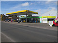
Living in CB25 0WY offers access to a range of nearby amenities, including five retail outlets such as Asda Burwell, Co-op Burwell, and M&S One Thousand Guineas BP. These shops provide essential services, from groceries to fuel, supporting daily convenience. The area is also served by five rail stations, including Newmarket Railway Station, facilitating easy travel to nearby towns and cities. The village’s character is enhanced by its historical features, such as Burwell Lode, which adds a unique charm to the local environment. While the data does not specify parks or leisure facilities, the presence of retail and transport options suggests a practical, community-focused lifestyle. The compact nature of the area means amenities are within practical reach, contributing to a balanced daily life that blends rural tranquillity with urban accessibility.
Amenities
Schools
The nearest school to CB25 0WY is Burwell Village College, a primary school with a Good Ofsted rating. This institution serves the local community, providing education for younger children within the village. The absence of secondary schools in the immediate area means families may need to look further afield for secondary education, though the primary school’s rating suggests a reliable foundation for early learning. The presence of a well-regarded primary school is a key factor for families prioritising local schooling, offering convenience and a sense of community. With no other schools listed in the data, the focus remains on Burwell Village College as the primary educational hub for the area.
| Rank | School | Type | Entry gender | Ages |
|---|
Explore more schools in this area
Go to Schools tabDemographics
The community in CB25 0WY is predominantly composed of adults aged 30 to 64, with a median age of 47. This suggests a mature, settled population, likely with established careers and families. Homeownership is high, with 78% of residents owning their homes, indicating a stable and long-term presence in the area. The accommodation type is primarily houses, reflecting a preference for private, detached living. The predominant ethnic group is White, though specific data on diversity is not provided. The population density of 1,325 people per square kilometre implies a compact, closely connected community. While no deprivation data is available, the high homeownership rate and age profile suggest a relatively affluent and low-turnover area. This demographic profile aligns with a lifestyle that values stability, with residents likely prioritising family-oriented living and proximity to local amenities.
Household Size
Accommodation Type
Tenure
Ethnic Group
Religion
Household Composition
Age
Household Deprivation
NS-SEC
Explore more demographic insights in this area
Go to Demographics tabPlanning
Planning Constraints
- Flood RiskPremium
- Ramsar Wetland SitesPremium
- Area of Outstanding Natural BeautyPremium
- Protected Nature ReservePremium
- Protected WoodlandPremium