Area Overview for CB25 0LT
Photos of CB25 0LT
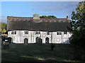

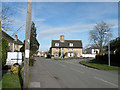
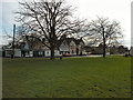
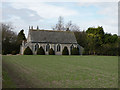
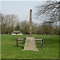
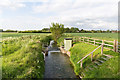

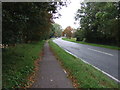
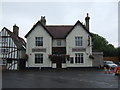
98 photos from this area
Area Information
Key information about the CB25 0LT including its size, population, and administrative classification.
- Area Type
- Postcode
- Area Size
- 3.4 hectares
- Population
- 2051
- Population Density
- 50 people/km²
House Prices in CB25 0LT
34
Properties
£233,245
Average Sold Price
£122,500
Lowest Price
£405,000
Highest Price
Showing 34 properties
| Address | Type | Beds | Baths | Last Sale Price | Last Sale Date | |
|---|---|---|---|---|---|---|
| The Hollies, 39 Maryland Avenue, Swaffham Bulbeck, CB25 0LT | Semi-detached | 4 | 1 | £405,000 | Feb 2025 | |
| 63 Maryland Avenue, Swaffham Bulbeck, CB25 0LT | Bungalow | 1 | 1 | £195,000 | Jun 2021 | |
| 37 Maryland Avenue, Swaffham Bulbeck, CB25 0LT | Semi-detached | 4 | 2 | £345,000 | Feb 2018 | |
| 40 Maryland Avenue, Swaffham Bulbeck, CB25 0LT | Semi-detached | 3 | 1 | £335,000 | Jun 2016 | |
| 43 Maryland Avenue, Swaffham Bulbeck, CB25 0LT | house | - | - | £145,000 | Oct 2014 | |
| 42 Maryland Avenue, Swaffham Bulbeck, CB25 0LT | Semi-detached | 3 | - | £225,000 | Aug 2013 | |
| 48 Maryland Avenue, Swaffham Bulbeck, CB25 0LT | house | - | - | £122,500 | Jul 2013 | |
| 32 Maryland Avenue, Swaffham Bulbeck, CB25 0LT | house | - | - | £205,000 | Apr 2012 | |
| 36 Maryland Avenue, Swaffham Bulbeck, CB25 0LT | house | - | - | £185,000 | Oct 2009 | |
| 38 Maryland Avenue, Swaffham Bulbeck, CB25 0LT | Semi-detached | - | - | £169,950 | Nov 2004 |
Page 1 of 4
Energy Efficiency in CB25 0LT
Amenities
Schools
| Rank | School | Type | Entry gender | Ages |
|---|
Explore more schools in this area
Go to Schools tabDemographics
Household Size
Two person
most common
Accommodation Type
Houses
most common
Tenure
68
majority
Ethnic Group
White
most common
Religion
N/A
most common
Household Composition
N/A
most common
Age
47
median
Adults (30-64 years)
most common
Household Deprivation
N/A
with no deprivation
NS-SEC
45
in Lower managerial occupations
Explore more demographic insights in this area
Go to Demographics tabPlanning
Planning Constraints
- Flood RiskPremium
- Ramsar Wetland SitesPremium
- Area of Outstanding Natural BeautyPremium
- Protected Nature ReservePremium
- Protected WoodlandPremium