Area Overview for CB25 0ES
Photos of CB25 0ES

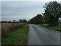
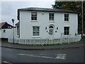
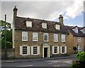
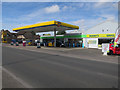
88 photos from this area
Area Information
Key information about the CB25 0ES including its size, population, and administrative classification.
- Area Type
- Postcode
- Area Size
- 9347 m²
- Population
- 1860
- Population Density
- 221 people/km²
House Prices in CB25 0ES
16
Properties
£170,875
Average Sold Price
£61,000
Lowest Price
£312,500
Highest Price
Showing 16 properties
| Address | Type | Beds | Baths | Last Sale Price | Last Sale Date | |
|---|---|---|---|---|---|---|
| Vanbergen, 26 Park Road, Burwell, CB25 0ES | Bungalow | 2 | 1 | £270,000 | Mar 2025 | |
| 16 Park Road, Burwell, CB25 0ES | Flat | - | - | £175,000 | Nov 2017 | |
| 32 Park Road, Burwell, CB25 0ES | Bungalow | 2 | 1 | £225,000 | Mar 2016 | |
| Fourways, 8 Park Road, Burwell, CB25 0ES | Bungalow | 3 | - | £312,500 | Oct 2012 | |
| 30 Park Road, Burwell, CB25 0ES | Bungalow | 2 | - | £171,000 | Jan 2011 | |
| 22 Park Road, Burwell, CB25 0ES | Detached | 2 | 1 | £205,000 | Oct 2007 | |
| 24 Park Road, Burwell, CB25 0ES | Detached | - | - | £180,000 | Jun 2006 | |
| 18 Park Road, Burwell, CB25 0ES | Flat | - | - | £138,000 | Jan 2006 | |
| 1 Park Road, Burwell, CB25 0ES | Detached | - | - | £143,500 | Mar 2002 | |
| 34 Park Road, Burwell, CB25 0ES | Detached | - | - | £97,500 | Jul 1999 |
Page 1 of 2
Energy Efficiency in CB25 0ES
Amenities
Schools
| Rank | School | Type | Entry gender | Ages |
|---|
Explore more schools in this area
Go to Schools tabDemographics
Household Size
Two person
most common
Accommodation Type
Houses
most common
Tenure
84
majority
Ethnic Group
White
most common
Religion
N/A
most common
Household Composition
N/A
most common
Age
47
median
Adults (30-64 years)
most common
Household Deprivation
N/A
with no deprivation
NS-SEC
44
in Lower managerial occupations
Explore more demographic insights in this area
Go to Demographics tabPlanning
Planning Constraints
- Flood RiskPremium
- Ramsar Wetland SitesPremium
- Area of Outstanding Natural BeautyPremium
- Protected Nature ReservePremium
- Protected WoodlandPremium