Area Overview for CB25 0DS
Photos of CB25 0DS
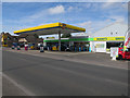
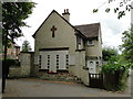
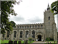
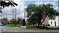
88 photos from this area
Area Information
Key information about the CB25 0DS including its size, population, and administrative classification.
- Area Type
- Postcode
- Area Size
- 1725 m²
- Population
- 1860
- Population Density
- 221 people/km²
House Prices in CB25 0DS
59
Properties
£90,260
Average Sold Price
£37,000
Lowest Price
£199,950
Highest Price
Showing 59 properties
| Address | Type | Beds | Baths | Last Sale Price | Last Sale Date | |
|---|---|---|---|---|---|---|
| 41 Ash Grove, Burwell, CB25 0DS | Flat | 1 | 1 | £80,000 | Feb 2025 | |
| 57 Ash Grove, Burwell, CB25 0DS | Flat | 1 | 1 | £67,500 | Nov 2024 | |
| 60 Ash Grove, Burwell, CB25 0DS | Flat | 1 | 1 | £90,000 | Oct 2024 | |
| 74 Ash Grove, Burwell, CB25 0DS | Flat | 1 | - | £82,500 | May 2024 | |
| 37 Ash Grove, Burwell, CB25 0DS | Flat | - | - | £73,000 | Mar 2024 | |
| 35 Ash Grove, Burwell, CB25 0DS | Flat | 1 | - | £68,000 | Feb 2024 | |
| 49 Ash Grove, Burwell, CB25 0DS | Flat | - | - | £90,000 | Nov 2023 | |
| 73 Ash Grove, Burwell, CB25 0DS | Flat | - | - | £145,000 | May 2023 | |
| 55 Ash Grove, Burwell, CB25 0DS | Retail | 2 | 1 | £120,000 | Mar 2023 | |
| 63 Ash Grove, Burwell, CB25 0DS | Retail | 1 | 1 | £80,000 | Nov 2022 |
Page 1 of 6
Energy Efficiency in CB25 0DS
Amenities
Schools
| Rank | School | Type | Entry gender | Ages |
|---|
Explore more schools in this area
Go to Schools tabDemographics
Household Size
Two person
most common
Accommodation Type
Houses
most common
Tenure
84
majority
Ethnic Group
White
most common
Religion
N/A
most common
Household Composition
N/A
most common
Age
47
median
Adults (30-64 years)
most common
Household Deprivation
N/A
with no deprivation
NS-SEC
44
in Lower managerial occupations
Explore more demographic insights in this area
Go to Demographics tabPlanning
Planning Constraints
- Flood RiskPremium
- Ramsar Wetland SitesPremium
- Area of Outstanding Natural BeautyPremium
- Protected Nature ReservePremium
- Protected WoodlandPremium