Area Overview for CB25 0AH
Photos of CB25 0AH


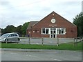
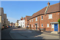
40 photos from this area
Area Information
Key information about the CB25 0AH including its size, population, and administrative classification.
- Area Type
- Postcode
- Area Size
- 35.7 hectares
- Population
- 1860
- Population Density
- 221 people/km²
House Prices in CB25 0AH
15
Properties
£364,938
Average Sold Price
£58,000
Lowest Price
£610,000
Highest Price
Showing 15 properties
| Address | Type | Beds | Baths | Last Sale Price | Last Sale Date | |
|---|---|---|---|---|---|---|
| 24 Reach Road, Burwell, CB25 0AH | house | 4 | - | £610,000 | Oct 2022 | |
| 28 Reach Road, Burwell, CB25 0AH | Bungalow | 3 | 2 | £515,000 | Jun 2022 | |
| 12 Reach Road, Burwell, CB25 0AH | Bungalow | - | - | £395,000 | Mar 2021 | |
| 30 Reach Road, Burwell, CB25 0AH | Semi-detached | 5 | 2 | £425,000 | Jan 2021 | |
| 22 Reach Road, Burwell, CB25 0AH | Detached | 3 | 3 | £525,000 | Dec 2019 | |
| 60 Reach Road, Burwell, CB25 0AH | house | - | - | £250,000 | Dec 2013 | |
| 14 Reach Road, Burwell, CB25 0AH | Terraced | 4 | 3 | £141,500 | Jul 1998 | |
| 34 Reach Road, Burwell, CB25 0AH | Semi-detached | - | - | £58,000 | Feb 1997 | |
| 16 Reach Road, Burwell, CB25 0AH | Detached | 3 | 2 | - | - | |
| ANNEXE, 16 SWAFFHAM ROAD, Reach, CB25 0AH | Flat | - | - | - | - |
Page 1 of 2
Energy Efficiency in CB25 0AH
Amenities
Schools
| Rank | School | Type | Entry gender | Ages |
|---|
Explore more schools in this area
Go to Schools tabDemographics
Household Size
Two person
most common
Accommodation Type
Houses
most common
Tenure
84
majority
Ethnic Group
White
most common
Religion
N/A
most common
Household Composition
N/A
most common
Age
47
median
Adults (30-64 years)
most common
Household Deprivation
N/A
with no deprivation
NS-SEC
44
in Lower managerial occupations
Explore more demographic insights in this area
Go to Demographics tabPlanning
Planning Constraints
- Flood RiskPremium
- Ramsar Wetland SitesPremium
- Area of Outstanding Natural BeautyPremium
- Protected Nature ReservePremium
- Protected WoodlandPremium