Area Overview for CB24 6DP
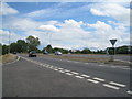
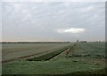
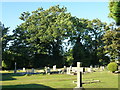
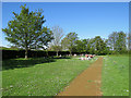
Photos of CB24 6DP
Area Information
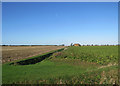
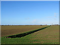
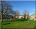
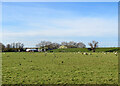
Living in CB24 6DP means being part of a small, tightly knit residential cluster in Cambridgeshire, just north of Cambridge. The area covers 1.4 hectares and is home to 1,354 people, creating a community where neighbours are likely to know one another. Situated along the Ely Road near the River Cam, it blends historical charm with modern convenience. The village of Milton, where this postcode lies, has roots in Anglo-Saxon times, with landmarks like All Saints’ Church and Milton House adding to its character. Daily life here is shaped by proximity to Cambridge, offering easy access to its cultural and professional opportunities while retaining a quieter, village atmosphere. The area’s compact size means amenities are within walking distance, and the population’s median age of 47 suggests a mature, stable community. Whether you’re drawn to its heritage or its practical location, CB24 6DP offers a blend of tradition and accessibility.
- Area Type
- Postcode
- Area Size
- 1.4 hectares
- Population
- 1354
- Population Density
- 806 people/km²
The property market in CB24 6DP is characterised by a strong presence of owner-occupied homes, with 64% of properties owned by residents. The area’s housing stock is dominated by houses rather than flats, reflecting a preference for family-friendly, standalone residences. Given the small size of the postcode area and its proximity to Cambridge, the housing stock is limited, making it a niche market for buyers seeking a quiet, village-like setting without the density of urban areas. The high home ownership rate suggests that properties here are often held long-term, with fewer rental properties available. For buyers, this means competition may be fierce, and properties are likely to be in demand from those prioritising location over size. The compact nature of the area also means that any new developments would be rare, preserving the existing character of the neighbourhood.
House Prices in CB24 6DP
Showing 34 properties
| Address | Type | Beds | Baths | Last Sale Price | Last Sale Date | |
|---|---|---|---|---|---|---|
| 12 David Bull Way, Milton, CB24 6DP | Detached | 4 | 3 | £490,000 | Sep 2025 | |
| 4 David Bull Way, Milton, CB24 6DP | Detached | 3 | 2 | £430,000 | May 2025 | |
| 39 David Bull Way, Milton, CB24 6DP | house | - | - | £465,000 | Nov 2023 | |
| 31 David Bull Way, Milton, CB24 6DP | Semi-detached | 3 | 2 | £412,500 | Sep 2023 | |
| 35 David Bull Way, Milton, CB24 6DP | house | 3 | 2 | £452,500 | Mar 2022 | |
| 20 David Bull Way, Milton, CB24 6DP | Semi-detached | 3 | - | £430,000 | Dec 2021 | |
| 24 David Bull Way, Milton, CB24 6DP | Detached | 4 | - | £502,000 | Nov 2019 | |
| 19 David Bull Way, Milton, CB24 6DP | Semi-detached | 3 | 1 | £380,000 | Sep 2019 | |
| 16 David Bull Way, Milton, CB24 6DP | Detached | 3 | - | £385,000 | Sep 2019 | |
| 2 David Bull Way, Milton, CB24 6DP | Detached | 4 | - | £430,000 | Feb 2017 |
Energy Efficiency in CB24 6DP
Daily life in CB24 6DP is enriched by nearby amenities that cater to practical needs and leisure. The area has five retail outlets, including Tesco Cambridge and the East of England Co-operative Co, ensuring access to groceries and essentials. For transport, two railway stations—Cambridge North and Waterbeach—offer easy links to Cambridge and surrounding areas, while proximity to Cambridge Airport provides regional travel options. The River Cam, running nearby, adds a recreational element, with historical sites like All Saints’ Church and Milton House offering cultural interest. The village’s small size means amenities are within walking distance, fostering a convenient, self-contained lifestyle. Whether shopping, commuting, or enjoying local history, residents have access to a mix of practical and leisure-focused facilities that enhance everyday living.
Amenities
Schools
The nearest school to CB24 6DP is the Red Balloon Learner Centre - Cambridge, an independent institution with a good Ofsted rating. This school caters to a range of ages and offers a private education option for families seeking alternative schooling. While no state schools are listed in the data, the presence of an independent school suggests that the area appeals to households prioritising choice in education. The good Ofsted rating indicates a satisfactory standard of teaching and facilities, though parents should consider the school’s specific curriculum and admission criteria. For families relying on state education, proximity to Cambridge’s larger schools may be necessary, but the Red Balloon Learner Centre provides a local alternative for those seeking independent education.
| Rank | School | Type | Entry gender | Ages |
|---|
Explore more schools in this area
Go to Schools tabDemographics
The population of CB24 6DP is 1,354, with a median age of 47 and the majority of residents aged between 30 and 64. This reflects a community skewed towards middle-aged adults, likely including families and professionals. Home ownership rates stand at 64%, with houses being the predominant accommodation type. The area’s demographic profile indicates a settled population, with few young families or retirees compared to other regions. The predominant ethnic group is White, though no specific diversity statistics are provided. The population density of 806 people per square kilometre suggests a mix of single-family homes and small households. While the data does not include deprivation metrics, the high home ownership rate and age profile imply a relatively stable economic environment, with residents prioritising long-term residency over transient living.
Household Size
Accommodation Type
Tenure
Ethnic Group
Religion
Household Composition
Age
Household Deprivation
NS-SEC
Explore more demographic insights in this area
Go to Demographics tabPlanning
Planning Constraints
- Flood RiskPremium
- Ramsar Wetland SitesPremium
- Area of Outstanding Natural BeautyPremium
- Protected Nature ReservePremium
- Protected WoodlandPremium