Area Overview for CB23 6JA
Photos of CB23 6JA
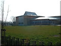
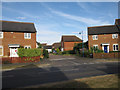
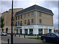
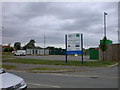
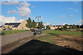
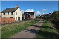
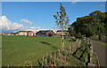
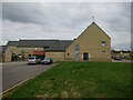
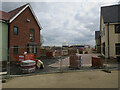
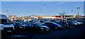
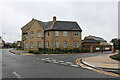
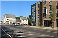
64 photos from this area
Area Information
Key information about the CB23 6JA including its size, population, and administrative classification.
- Area Type
- Postcode
- Area Size
- 3.1 hectares
- Population
- 2831
- Population Density
- 201 people/km²
House Prices in CB23 6JA
75
Properties
£354,608
Average Sold Price
£125,000
Lowest Price
£615,000
Highest Price
Showing 75 properties
| Address | Type | Beds | Baths | Last Sale Price | Last Sale Date | |
|---|---|---|---|---|---|---|
| 23 Bisley Crescent, Cambourne, CB23 6JA | Detached | 5 | 3 | £615,000 | Jul 2025 | |
| 40 Bisley Crescent, Cambourne, CB23 6JA | Semi-detached | 3 | 1 | £343,000 | Mar 2024 | |
| 45 Bisley Crescent, Cambourne, CB23 6JA | Semi-detached | 3 | 1 | £325,000 | Mar 2024 | |
| 52 Bisley Crescent, Cambourne, CB23 6JA | Detached | 4 | 2 | £528,000 | Nov 2023 | |
| 16 Bisley Crescent, Cambourne, CB23 6JA | Retail | 5 | 4 | £585,000 | Jul 2022 | |
| 59 Bisley Crescent, Cambourne, CB23 6JA | house | - | - | £198,750 | Apr 2022 | |
| 3A Bisley Crescent, Cambourne, CB23 6JA | Semi-detached | 2 | 2 | £278,000 | Mar 2022 | |
| 1 Bisley Crescent, Cambourne, CB23 6JA | Terraced | 3 | 1 | £327,500 | Dec 2021 | |
| 72 Bisley Crescent, Cambourne, CB23 6JA | house | - | - | £435,000 | Nov 2021 | |
| 25 Bisley Crescent, Cambourne, CB23 6JA | house | - | - | £450,000 | Jun 2021 |
Page 1 of 8
Energy Efficiency in CB23 6JA
Amenities
Schools
| Rank | School | Type | Entry gender | Ages |
|---|
Explore more schools in this area
Go to Schools tabDemographics
Household Size
Family (3-5 people)
most common
Accommodation Type
Houses
most common
Tenure
78
majority
Ethnic Group
White
most common
Religion
N/A
most common
Household Composition
N/A
most common
Age
47
median
Adults (30-64 years)
most common
Household Deprivation
N/A
with no deprivation
NS-SEC
53
in Lower managerial occupations
Explore more demographic insights in this area
Go to Demographics tabPlanning
Planning Constraints
- Flood RiskPremium
- Ramsar Wetland SitesPremium
- Area of Outstanding Natural BeautyPremium
- Protected Nature ReservePremium
- Protected WoodlandPremium