Area Overview for CB23 6FD
Photos of CB23 6FD
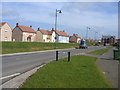
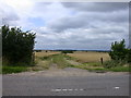
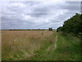
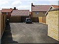
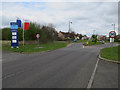
48 photos from this area
Area Information
Key information about the CB23 6FD including its size, population, and administrative classification.
- Area Type
- Postcode
- Area Size
- 8879 m²
- Population
- 1320
- Population Density
- 618 people/km²
House Prices in CB23 6FD
26
Properties
£278,615
Average Sold Price
£141,500
Lowest Price
£535,500
Highest Price
Showing 26 properties
| Address | Type | Beds | Baths | Last Sale Price | Last Sale Date | |
|---|---|---|---|---|---|---|
| 31 Woodfield Lane, Cambourne, CB23 6FD | Semi-detached | 3 | 2 | £350,000 | Apr 2024 | |
| 39 Woodfield Lane, Cambourne, CB23 6FD | Terraced | 2 | 1 | £270,000 | Aug 2023 | |
| 49 Woodfield Lane, Cambourne, CB23 6FD | Retail | 4 | 1 | £535,500 | Sep 2022 | |
| 47 Woodfield Lane, Cambourne, CB23 6FD | Semi-detached | 4 | - | £395,000 | Dec 2017 | |
| 51 Woodfield Lane, Cambourne, CB23 6FD | house | 4 | - | £420,000 | Jun 2016 | |
| 43 Woodfield Lane, Cambourne, CB23 6FD | Maisonette | 1 | - | £153,000 | Jun 2015 | |
| 35 Woodfield Lane, Cambourne, CB23 6FD | Terraced | - | - | £222,000 | Dec 2014 | |
| 37 Woodfield Lane, Cambourne, CB23 6FD | Terraced | 2 | 1 | £168,000 | Mar 2014 | |
| 29 Woodfield Lane, Cambourne, CB23 6FD | Retail | 3 | 1 | £190,000 | Apr 2013 | |
| 45 Woodfield Lane, Cambourne, CB23 6FD | house | 4 | - | £250,000 | May 2012 |
Page 1 of 3
Energy Efficiency in CB23 6FD
Amenities
Schools
| Rank | School | Type | Entry gender | Ages |
|---|
Explore more schools in this area
Go to Schools tabDemographics
Household Size
Family (3-5 people)
most common
Accommodation Type
Houses
most common
Tenure
61
majority
Ethnic Group
White
most common
Religion
N/A
most common
Household Composition
N/A
most common
Age
47
median
Adults (30-64 years)
most common
Household Deprivation
N/A
with no deprivation
NS-SEC
50
in Lower managerial occupations
Explore more demographic insights in this area
Go to Demographics tabPlanning
Planning Constraints
- Flood RiskPremium
- Ramsar Wetland SitesPremium
- Area of Outstanding Natural BeautyPremium
- Protected Nature ReservePremium
- Protected WoodlandPremium